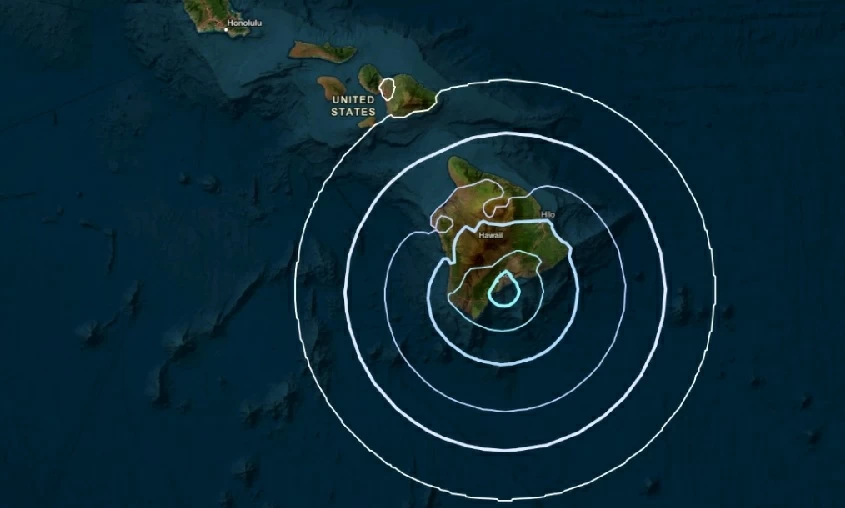
ضرب زلزال بقوة 5.1 درجة جنوب شرقي مدينة ناهيلو في ولاية هاواي الأمريكية، في هزة أرضية جديدة أعادت التذكير بالنشاط الجيولوجي المتصاعد في تلك المنطقة الواقعة ضمن نطاق (حزام النار) بالمحيط الهادئ.
وأوضحت هيئة المسح الجيولوجي الأمريكية أن مركز الزلزال وقع على مسافة 45 كيلومترًا من ناهيلو، وعلى عمق بلغ 7.2 كيلومتر، ما جعله محسوسًا في عدد من المناطق المحيطة دون تسجيل أضرار كبيرة حتى الآن.
ويُعد موقع هاواي واحدًا من أكثر المناطق نشاطًا على مستوى العالم، إذ يشهد بين الحين والآخر هزات أرضية وزلازل ارتدادية متفاوتة القوة، بفعل وجوده على حافة الصفائح التكتونية النشطة، فضلًا عن احتضان الجزيرة لجبل كيلاوا البركاني الذي يُعد من أكثر البراكين نشاطًا في العالم.
وتأتي الهزة الأخيرة في سياق سلسلة من التحركات الجيولوجية التي تراقبها السلطات الأمريكية عن كثب، تحسبًا لأي نشاط بركاني أو زلزالي قد يتصاعد خلال الفترة المقبلة.
A 5.1 magnitude earthquake struck southeast of the town of Nahiku in the state of Hawaii, in a new tremor that reminded of the increasing geological activity in that area, which lies within the (Ring of Fire) in the Pacific Ocean.
The U.S. Geological Survey indicated that the epicenter of the earthquake was located 45 kilometers from Nahiku, at a depth of 7.2 kilometers, making it felt in several surrounding areas without reporting significant damage so far.
Hawaii is considered one of the most active regions in the world, experiencing occasional tremors and aftershocks of varying strength, due to its location on the edge of active tectonic plates, in addition to the island hosting the Kilauea volcano, which is one of the most active volcanoes in the world.
The recent tremor comes in the context of a series of geological movements that U.S. authorities are closely monitoring, in anticipation of any volcanic or seismic activity that may escalate in the coming period.