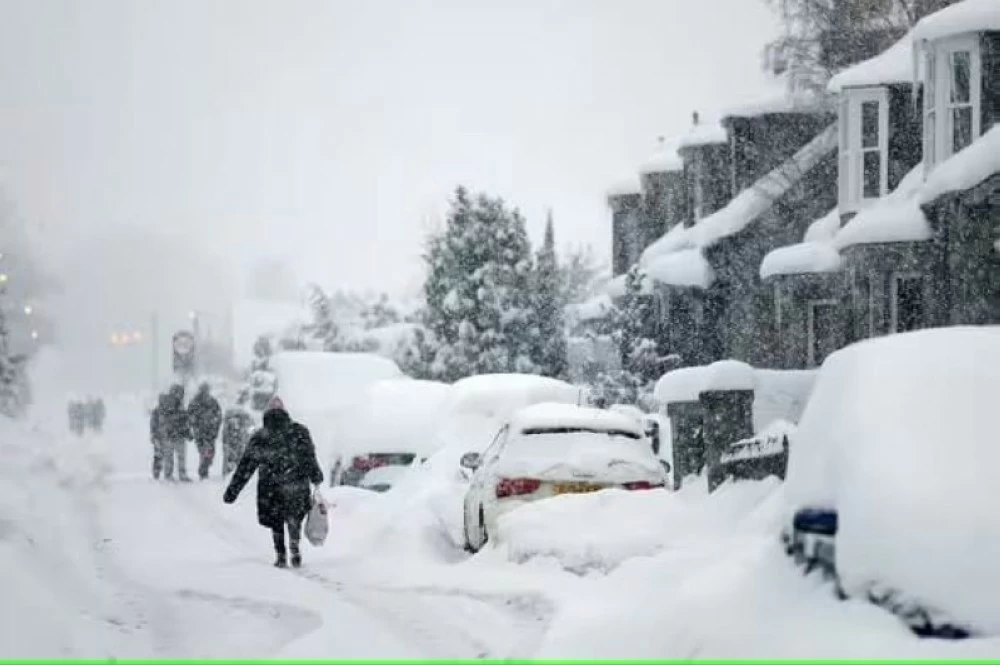
تستعد أجزاء واسعة من المملكة المتحدة لموجة طقس شديدة البرودة، مع توقعات بتعرضها لعاصفة ثلجية قد تستمر لنحو 33 ساعة متواصلة، ومن المنتظر أن تنخفض درجات الحرارة إلى (-4) درجة مئوية خلال الأيام القليلة القادمة.
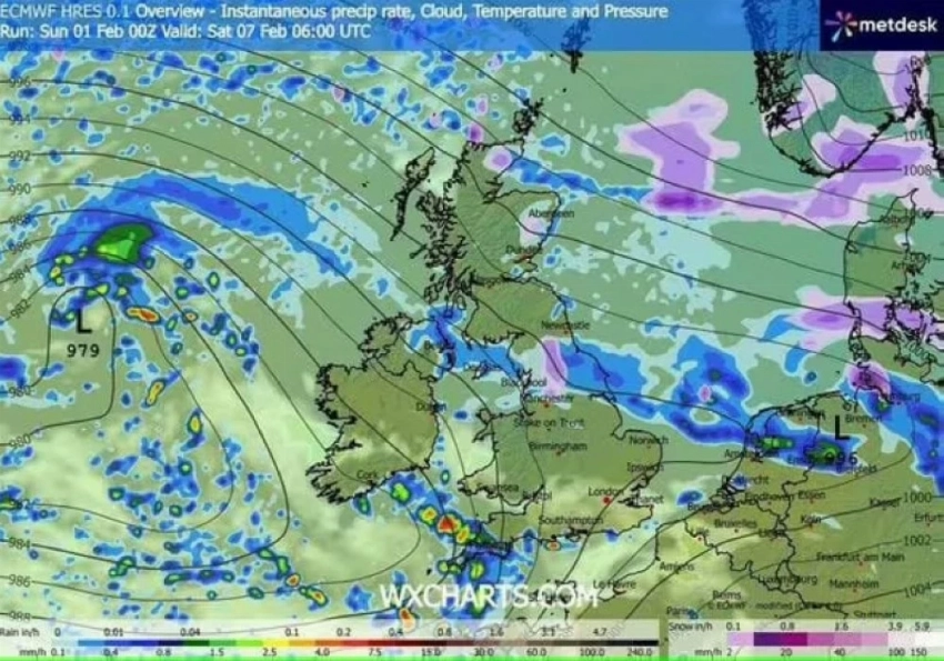
ووفقاً لخرائط الطقس الصادرة عن موقع WXCharts، يُتوقع أن تبدأ الأحوال الجوية الثلجية مساء 5 فبراير عند التاسعة، وتستمر حتى صباح 7 فبراير عند السادسة.
وبحسب موقع Mirror، فقد أظهرت الخرائط تحول مساحات واسعة إلى اللونين الأبيض والبنفسجي، في إشارة إلى احتمالية تساقط الثلوج وسيادة أجواء شتوية قاسية.
وتشير التوقعات إلى أن عدة مناطق في إنجلترا وأسكتلندا ستكون تحت غطاء ثلجي، مع تأثر نحو 13 مقاطعة في مختلف أنحاء المملكة المتحدة بهذه الموجة الباردة القاسية.
1
أما التوقعات الجوية بعيدة المدى، للفترة الممتدة بين 6 و15 فبراير، فتوضح أن أنظمة جوية قادمة من المحيط الأطلسي، مدفوعة بانزياح التيار النفاث نحو الجنوب، ستقترب من المملكة المتحدة على فترات، لكنها قد تتباطأ أو تتوقف بفعل تمركز منطقة ضغط جوي مرتفع شمالاً وشمال شرق البلاد.
ومن المتوقع أن يؤدي ذلك إلى هطول أمطار متكررة، لا سيما في المناطق التي تعاني بالفعل من مخاطر الفيضانات، ومع تحرك هذه الجبهات الماطرة شمالاً، قد تتحول الأمطار إلى ثلوج في شمال إنجلترا وأسكتلندا، خصوصاً في المناطق المرتفعة، نتيجة اصطدامها بكتل هوائية أكثر برودة.
كما تشير التوقعات إلى احتمال تحرك مناطق الضغط المنخفض جنوباً خلال الأسبوع الثاني من فبراير، ما قد يسمح بامتداد الهواء البارد إلى مساحات أوسع من المملكة المتحدة، بما في ذلك المناطق الجنوبية، الأمر الذي يرفع من احتمالات المخاطر الشتوية لفترة مؤقتة.
Large parts of the United Kingdom are preparing for a severe cold weather wave, with forecasts predicting a snowstorm that could last for about 33 continuous hours, and temperatures are expected to drop to (-4) degrees Celsius in the coming days.
According to weather maps issued by WXCharts, snowy conditions are expected to begin on the evening of February 5 at 9 PM and continue until the morning of February 7 at 6 AM.
According to the Mirror website, the maps have shown large areas turning white and purple, indicating the likelihood of snowfall and the dominance of harsh winter conditions.
Forecasts suggest that several areas in England and Scotland will be under a snow cover, with around 13 counties across the United Kingdom affected by this severe cold wave.
1
As for the long-range weather forecasts for the period between February 6 and 15, they indicate that weather systems coming from the Atlantic Ocean, driven by a southward shift of the jet stream, will approach the United Kingdom intermittently, but they may slow down or stop due to the presence of a high-pressure area to the north and northeast of the country.
This is expected to lead to repeated rainfall, especially in areas already at risk of flooding, and as these rainy fronts move northward, the rain may turn to snow in northern England and Scotland, particularly in elevated areas, due to their collision with colder air masses.
Forecasts also indicate the possibility of low-pressure areas moving southward during the second week of February, which could allow cold air to extend over wider areas of the United Kingdom, including southern regions, raising the likelihood of temporary winter hazards.