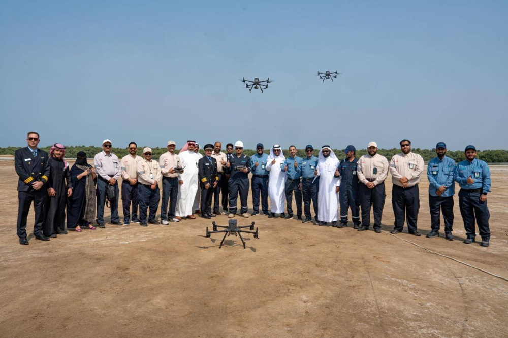
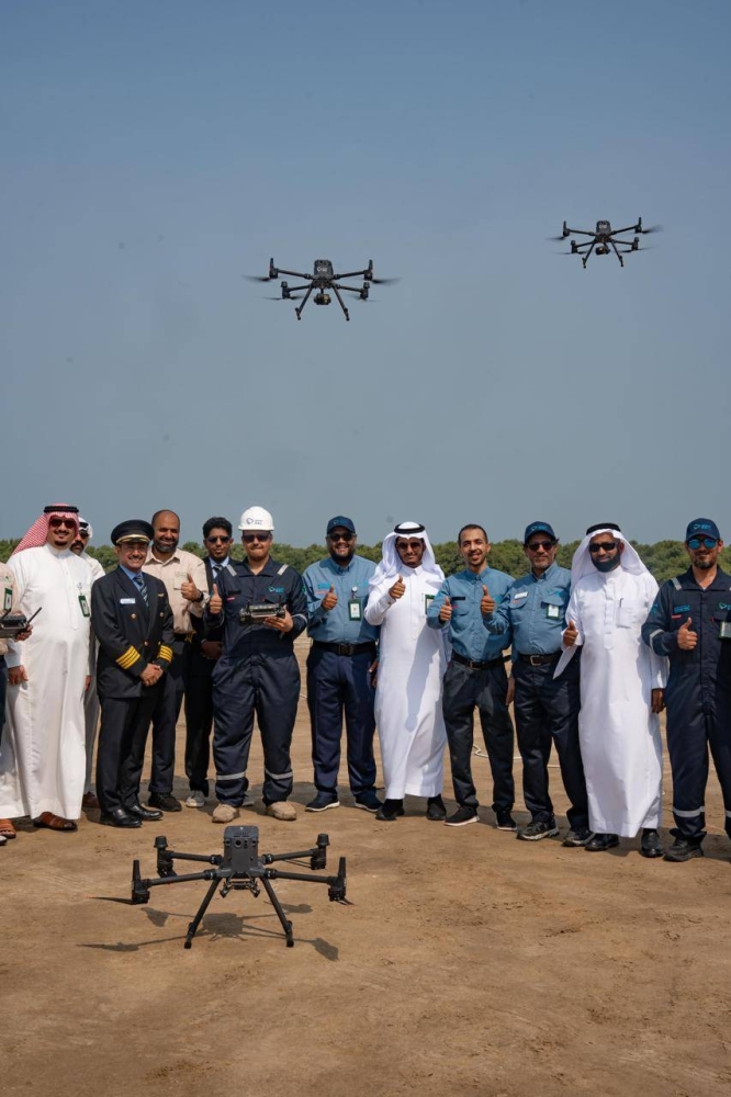
أطلق المركز الوطني للرقابة على الالتزام البيئي، بالتعاون مع شركة الأعمال البحرية للخدمات البيئية «سيل»، برنامجاً لمراقبة سواحل المملكة بواسطة طائرات «الدرون»، والتي تعمل على نقل صور ولقطات حية وتحليل يكشف أي ممارسات تهدد سلامة الموارد البحرية.
وأوضح مدير عام شبكات الرصد في المركز المهندس عامر بامنيف أن برنامج الدرون يشكل إضافة لعمليات الرقابة بواسطة تقنيات حديثة يمكن من خلالها توسيع النطاق الجغرافي، واختصار الجهد في تحديد أي ممارسات خاطئة ينتج عنها تلوث لسواحل المملكة، مشيراً إلى أن ذلك سيسهم في سرعة الاستجابة والتوجه إلى المواقع المرصودة لتحديد أسباب التلوث والمسؤول عنه.
من جانبه، بين مدير إدارة المبادرة البحرية في شركة «سيل» المهندس فارس السعدون قدرات طائرات الدرون الفنية، إذ تقوم بالتصوير الحراري، وأخذ الصور واللقطات عالية الجودة لرصد أي تغيّر طارئ على البيئات الساحلية، وتقترب من الملوثات إلى مسافة تصل إلى أقل من 1.2 كيلومتر ما يوفّر تحديداً دقيقاً للملوثات، ولقطات شديدة الوضوح لأماكن الملوّثات، سواءً كانت الصور ثابتة أو متحركة أو تصويراً حرارياً، منوهاً بأن كل طائرة يمكنها القيام بتلك المهمات في طلعة على مسافة تصل إلى 20 كيلومتراً، وفي مدة تصل إلى 55 دقيقة، ونقل ذلك بشكل مباشر وآني إلى غرف المراقبة والسيطرة، الذين يقومون بدورهم برفع البلاغات والتقارير المصورة للمختصين في المركز الوطني للرقابة على الالتزام البيئي، والذين بدورهم يقومون بإرسال المفتشين لأخذ العينات وتحليلها ورفع التقارير الشاملة للجهات المختصة لاتخاذ الإجراءات اللازمة لحماية الموارد الطبيعية.
The National Center for Environmental Compliance Monitoring, in collaboration with the Marine Business Company for Environmental Services "Seal," has launched a program to monitor the coasts of the Kingdom using "drone" aircraft, which transmit live images and footage and analyze any practices that threaten the safety of marine resources.
The Director General of Monitoring Networks at the center, Engineer Amer Baminif, explained that the drone program is an addition to monitoring operations using modern technologies that allow for an expanded geographical scope and reduce the effort in identifying any wrongful practices that result in pollution of the Kingdom's coasts. He pointed out that this will contribute to a quicker response and direct attention to the monitored locations to identify the causes of pollution and those responsible for it.
For his part, the Director of the Marine Initiative Department at "Seal," Engineer Fares Al-Sadoon, highlighted the technical capabilities of the drones, as they perform thermal imaging and capture high-quality images and footage to monitor any sudden changes in coastal environments. They can approach pollutants to a distance of less than 1.2 kilometers, providing precise identification of pollutants and extremely clear footage of pollution locations, whether the images are still or moving or thermal imaging. He noted that each drone can carry out these missions in a flight covering a distance of up to 20 kilometers, within a duration of up to 55 minutes, and transmit that information directly and in real-time to the monitoring and control rooms, which in turn raise reports and documented footage to the specialists at the National Center for Environmental Compliance Monitoring, who then send inspectors to collect samples, analyze them, and submit comprehensive reports to the relevant authorities to take necessary actions to protect natural resources.