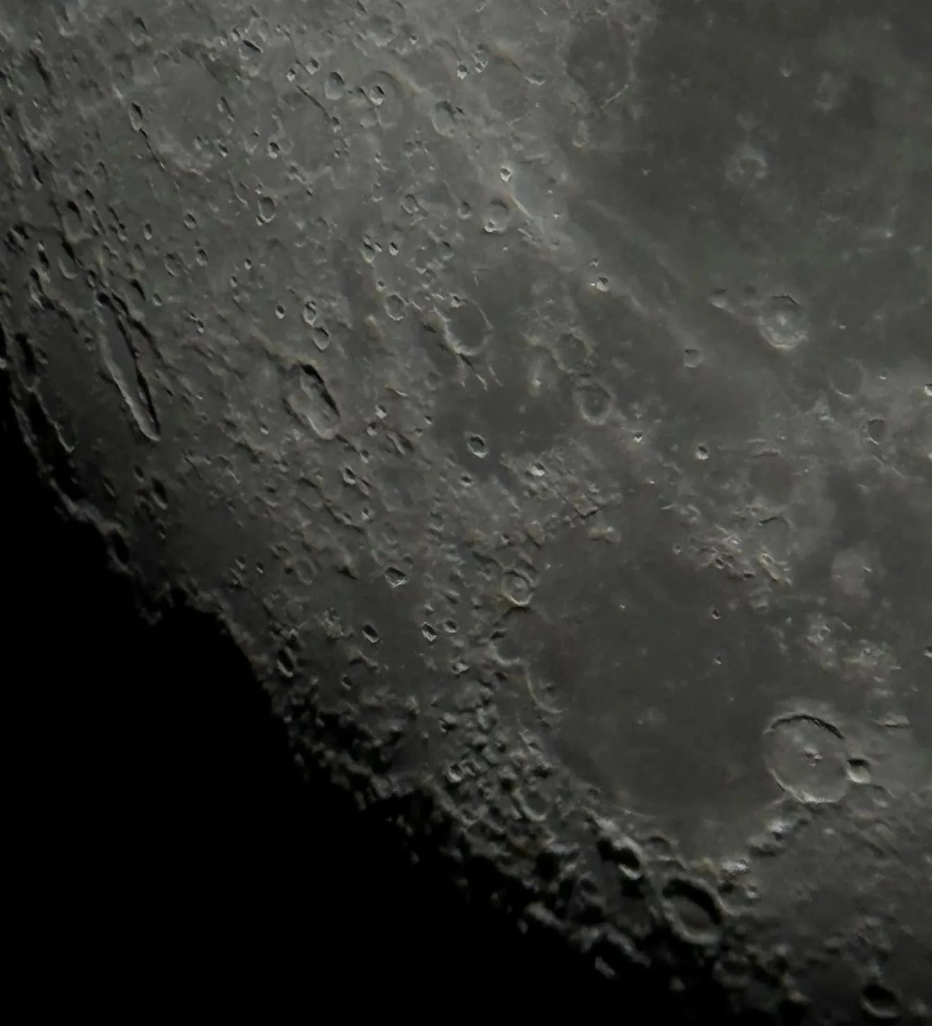
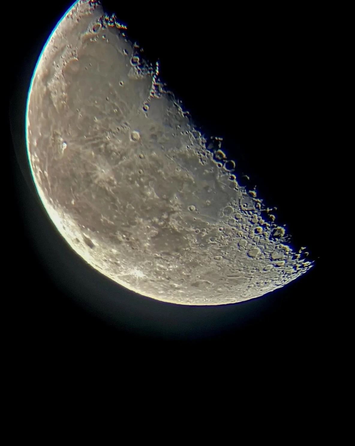
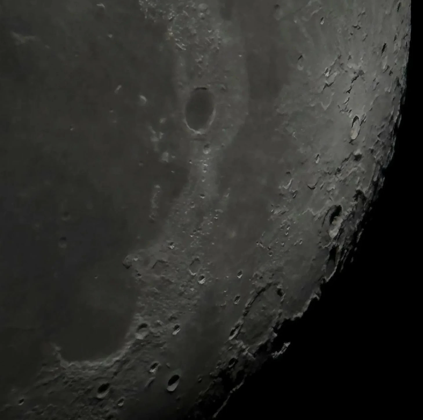
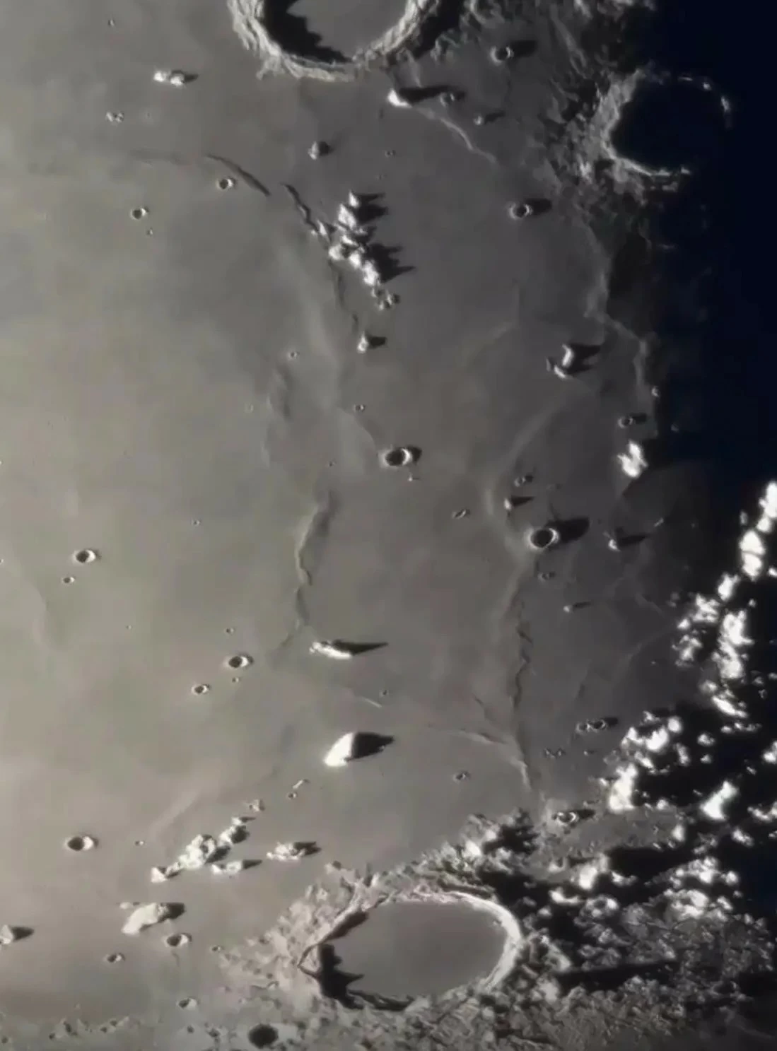
أتاح رصد تضاريس القمر بمرحلة التربيع الأخير في سماء محافظة رفحاء بمنطقة الحدود الشمالية أمس مشاهدة عدد من أبرز المعالم التي تشكل سطحه، وفي مقدمتها الفوهات الصدمية والمناطق المرتفعة والمنخفضات الداكنة، التي تمثل سجلًا طبيعيًا يوثق جانبًا مهمًا من تاريخه الجيولوجي وتطور النظام الشمسي المبكر.
وأوضح عضو جمعية آفاق لعلوم الفلك برجس الفليح لـ«واس» أن رصد تضاريس القمر أمس أظهر عددًا من تفاصيل سطحه، من بينها الفوهات الصدمية والمرتفعات والمناطق الداكنة، موضحًا أن درجة وضوحها تتأثر بمرحلة القمر وتوقيت الرصد وصفاء الأجواء والأدوات الفلكية المستخدمة.
وبيّن أن تضاريس القمر تشكلت بصورة رئيسية بفعل الارتطامات النيزكية واسعة النطاق والنشاط البركاني القديم، ولا تزال آثار هذه العمليات محفوظة بدرجة كبيرة؛ نتيجة محدودية عمليات التعرية على سطحه مقارنة بالأرض، ما يجعل تضاريسه مصدرًا مهمًا لدراسة تاريخه الجيولوجي.
وتبرز الفوهات الصدمية بوصفها من أكثر المعالم انتشارًا على سطح القمر، وهي نتاج اصطدام الكويكبات والنيازك والمذنبات بسطحه على مدى مليارات السنين، وتختلف هذه الفوهات في أحجامها وأشكالها، فيما تكشف بعضها عن مواد من طبقات أعمق من القشرة القمرية، وتوفر مؤشرات على طبيعة الارتطامات التي أسهمت في تشكيل سطحه.
وأشار الفليح إلى أن الفوهات القمرية تبدو أكثر وضوحًا عند اقتراب القمر من طور التربيع، إذ تسهم الظلال الممتدة على حوافها ومنحدراتها في إبراز تفاصيلها، مقارنة بفترة البدر التي تقل فيها الظلال وتبدو بعض التضاريس أقل تباينًا.
وتظهر إلى جانبها البحار القمرية، وهي مناطق داكنة واسعة لا تمثل بحارًا مائية، وإنما سهول بركانية تشكلت عندما غمرت تدفقات من الحمم البازلتية أحواضًا ومنخفضات واسعة نتجت عن اصطدامات كبرى، وتتميز هذه المناطق بلونها الداكن مقارنة بالمرتفعات القمرية الأكثر سطوعًا، وترتبط باختلافات في التركيب المعدني والعمر الجيولوجي لسطح القمر.
كما تكشف التضاريس القمرية سلاسل جبلية ومرتفعات شاهقة تختلف في نشأتها عن معظم جبال الأرض؛ إذ ارتبط تشكل كثير منها بالارتطامات العملاقة التي أحدثت أحواضًا واسعة، وأسهمت قوى الاصطدام وارتداد سطح القمر في تشكيل حواف مرتفعة ومعقدة حولها.
وأكد عضو جمعية آفاق لعلوم الفلك أن رصد القمر لا يقتصر على الجانب الجمالي، بل يمثل وسيلة مبسطة للتعرف على تاريخه الجيولوجي، موضحًا أن متابعة تغير الإضاءة والظلال على سطحه تساعد على تمييز الفوهات والجبال والسهول البركانية، وتدعم نشر الثقافة الفلكية بين أفراد المجتمع.
وتتيح دراسة هذه المعالم للعلماء إعادة بناء مراحل مهمة من التاريخ الجيولوجي للقمر، وفهم طبيعة الارتطامات والنشاط البركاني الذي مر به، إلى جانب الاستفادة منها في تحديد خصائص المواقع المرشحة للهبوط والاستكشاف في المهمات القمرية المستقبلية.
The observation of the moon's terrain during the last quarter phase in the sky of Rafha province in the Northern Borders region yesterday allowed for the viewing of several prominent features that shape its surface, including impact craters, elevated areas, and dark lowlands, which represent a natural record documenting an important aspect of its geological history and the early development of the solar system.
Member of the Horizons Astronomy Society, Barjas Al-Falih, explained to "WAS" that the observation of the moon's terrain yesterday revealed several details of its surface, including impact craters, highlands, and dark areas, noting that their clarity is affected by the moon's phase, the timing of the observation, the atmospheric clarity, and the astronomical tools used.
He indicated that the moon's terrain was primarily formed due to large-scale meteoric impacts and ancient volcanic activity, and the effects of these processes are still largely preserved due to the limited erosion on its surface compared to Earth, making its terrain an important source for studying its geological history.
Impact craters stand out as some of the most widespread features on the moon's surface, resulting from the collision of asteroids, meteors, and comets with its surface over billions of years. These craters vary in size and shape, with some revealing materials from deeper layers of the lunar crust, providing indicators of the nature of the impacts that contributed to shaping its surface.
Al-Falih pointed out that lunar craters appear clearer as the moon approaches the quarter phase, as the shadows extending along their edges and slopes highlight their details, compared to the full moon phase when shadows are reduced and some terrains appear less distinct.
Alongside them are the lunar maria, which are vast dark areas that do not represent water bodies but rather volcanic plains formed when flows of basaltic lava flooded wide basins and depressions resulting from major impacts. These areas are characterized by their dark color compared to the brighter lunar highlands and are associated with differences in mineral composition and the geological age of the moon's surface.
The lunar terrain also reveals mountain ranges and highlands that differ in their formation from most mountains on Earth; many of them are linked to giant impacts that created wide basins, and the forces of impact and the rebound of the moon's surface contributed to forming elevated and complex edges around them.
The member of the Horizons Astronomy Society emphasized that observing the moon is not limited to its aesthetic aspect but represents a simplified means of understanding its geological history, explaining that monitoring changes in lighting and shadows on its surface helps distinguish craters, mountains, and volcanic plains, and supports the dissemination of astronomical culture among community members.
Studying these features allows scientists to reconstruct important stages of the moon's geological history and understand the nature of the impacts and volcanic activity it has undergone, in addition to benefiting from them in identifying the characteristics of sites proposed for landing and exploration in future lunar missions.