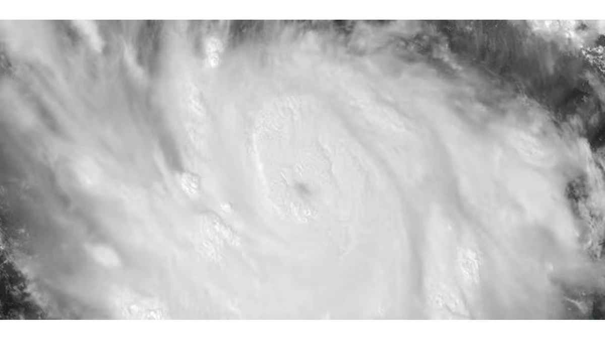
اشتد الإعصار «بولو» إلى الفئة الخامسة، وهي أعلى درجة على مقياس «سافير-سيمبسون»، أثناء تحركه قبالة الساحل الجنوبي الغربي للمكسيك، وسط تحذيرات من أمطار غزيرة قد تتسبب في فيضانات وانهيارات أرضية خطرة.
رياح تتجاوز 260 كيلومتراً
وأفاد المركز الوطني الأمريكي للأعاصير بأن سرعة الرياح المستمرة المصاحبة لـ«بولو» تجاوزت 260 كيلومتراً في الساعة، ليصبح إعصاراً من الفئة الخامسة بعد عملية اشتداد سريعة خلال فترة قصيرة.
وكان «بولو» لا يزال عاصفة استوائية في وقت سابق من الأسبوع، قبل أن تتزايد قوته بصورة متسارعة فوق مياه المحيط الهادئ الدافئة قبالة المكسيك.
مركز الإعصار يبقى في البحر
وبحسب أحدث التوقعات، يُرجح أن يبقى مركز الإعصار بعيداً عن اليابسة أثناء تحركه بمحاذاة الساحل المكسيكي، إلا أن السلطات حذرت من أن التأثيرات الخطرة لا تقتصر على مركزه.
وكان «بولو» يتمركز على بعد نحو 330 كيلومتراً جنوب مدينة زيهواتانيخو، ويتحرك ببطء قبالة الساحل الجنوبي الغربي للبلاد.
خطر الفيضانات والانهيارات
ومن المتوقع أن تتلقى أجزاء من ولايتي غيريرو وميتشواكان أمطاراً غزيرة خلال الأيام القادمة، مع احتمال تسجيل كميات أكبر محلياً في بعض المناطق الجبلية.
وحذر المركز الوطني للأعاصير من إمكانية تسبب الأمطار في فيضانات مفاجئة وانهيارات أرضية تهدد الحياة، خصوصاً في المناطق ذات التضاريس المرتفعة، فيما قد تمتد الأمطار أيضاً إلى أجزاء من أواكساكا وكوليما وخاليسكو.
تحذيرات على الساحل
كما يتوقع أن تتسبب الأمواج الناتجة عن الإعصار في ارتفاع خطورة البحر والتيارات الساحلية على أجزاء من الساحل المكسيكي، مع سريان تحذيرات من ظروف العاصفة الاستوائية في بعض المناطق.
وأعلنت السلطات المكسيكية إجراءات احترازية في المناطق المعرضة للخطر، ودعت السكان إلى الابتعاد عن مجاري المياه والمناطق المنخفضة والاستعداد للانتقال إلى أماكن أكثر أماناً إذا استدعت الظروف ذلك.
The hurricane "Polo" intensified to a Category 5, the highest level on the "Saffir-Simpson" scale, as it moved off the southwestern coast of Mexico, amid warnings of heavy rains that could cause dangerous flooding and landslides.
Winds Exceeding 260 Kilometers
The National Hurricane Center reported that the sustained winds associated with "Polo" exceeded 260 kilometers per hour, making it a Category 5 hurricane after a rapid intensification over a short period.
"Polo" was still a tropical storm earlier in the week before its strength increased rapidly over the warm waters of the Pacific off Mexico.
The Hurricane Center Remains at Sea
According to the latest forecasts, the center of the hurricane is expected to remain offshore as it moves along the Mexican coast, but authorities warned that the dangerous effects are not limited to its center.
"Polo" was located about 330 kilometers south of Zihuatanejo and was moving slowly off the southwestern coast of the country.
Flood and Landslide Risks
Parts of the states of Guerrero and Michoacán are expected to receive heavy rains in the coming days, with the possibility of recording higher amounts locally in some mountainous areas.
The National Hurricane Center warned that the rains could cause flash flooding and life-threatening landslides, especially in areas with elevated terrain, while the rains may also extend to parts of Oaxaca, Colima, and Jalisco.
Coastal Warnings
Waves generated by the hurricane are also expected to increase the danger of the sea and coastal currents along parts of the Mexican coast, with tropical storm conditions being warned in some areas.
Mexican authorities announced precautionary measures in at-risk areas and urged residents to stay away from waterways and low-lying areas and to prepare to move to safer locations if conditions require it.