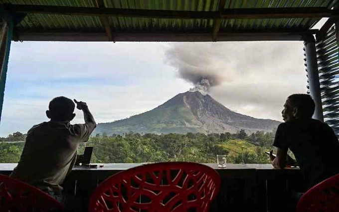
اتسعت تداعيات ثوران بركان «أناك كراكاتاو» في إندونيسيا، الأحد، مع امتداد سحابة الرماد البركاني إلى مناطق واسعة من غرب البلاد، وتعليق عمليات ستة مطارات، فيما ارتفع عدد الرحلات المتأثرة إلى 301 رحلة، بينها 58 دولية، وفق أحدث البيانات الرسمية.
وأعلنت السلطات الإندونيسية تعليق العمليات في عدد من المطارات بعد رصد الرماد البركاني في مسارات الطيران، من بينها مطار «سويكارنو هاتا» الدولي الرئيسي في جاكرتا، في خطوة احترازية تهدف إلى حماية حركة الملاحة الجوية من مخاطر السحابة البركانية.
وقالت وكالة الأرصاد الجوية والمناخ والجيوفيزياء الإندونيسية «BMKG» إن صور الأقمار الصناعية أظهرت وجود مجموعتين رئيسيتين من الرماد البركاني تغطيان أجزاء من بانتن وجاكرتا وجاوة الغربية وصولًا إلى بنغكولو، مع اختلاف اتجاهات حركة الرماد بحسب الارتفاع.
وأوضحت الوكالة أن الرماد وصل إلى ارتفاع نحو 20 ألف قدم واتجه شرقًا، بينما امتدت سحابة أخرى إلى ارتفاع يقارب 50 ألف قدم، وتحركت باتجاهات غربية وجنوبية غربية، لتغطي أجزاء من بانتن ولامبونغ وبنغكولو ومضيق سوندا والمحيط الهندي.
ودفعت هذه التطورات سلطات الطيران إلى إصدار تحذيرات متتالية وإغلاق أجواء ومطارات بصورة مؤقتة وفق تطورات انتشار الرماد، في وقت أكدت فيه «BMKG» أنها كثفت المراقبة على مدار الساعة لحركة السحابة وتأثيرها المحتمل على الطيران والأحوال البحرية في المنطقة.
وأصدرت السلطات حتى الآن 18 تحذيرًا جويًا متتابعًا يتعلق بالرماد البركاني، في محاولة لتوفير تحديثات مستمرة لشركات الطيران وأطقم الملاحة بشأن تغير مسارات السحابة وارتفاعاتها.
ولا يقتصر تأثير الثوران على الطيران؛ إذ تسببت جزيئات الرماد في اضطرابات ببعض الأنشطة اليومية في المناطق المتأثرة، بينما أوقفت بعض المدارس أنشطة خارجية، كما جرى تعليق أنشطة الصيد في مناطق متضررة بسبب مخاوف صحية وسلامة مرتبطة بتساقط الرماد.
وفي تطور لافت، قالت «BMKG» إن أجهزة رصد مستوى سطح البحر في محيط مضيق سوندا لم تسجل، حتى الساعات الأولى من الأحد، أي مؤشرات غير طبيعية مرتبطة بارتفاع المياه، فيما أظهرت أنظمة الرصد أن احتمال حدوث موجات تسونامي كان منخفضًا، مع بقاء ارتفاع الأمواج عند مستويات تقارب مترًا واحدًا.
ويحظى «أناك كراكاتاو» بمتابعة خاصة بسبب تاريخه الحديث؛ ففي ديسمبر 2018 تسبب انهيار جزء من البركان عقب ثورانه في حدوث تسونامي مدمر ضرب سواحل إندونيسيا، وأسفر عن مئات القتلى، ما جعل أي نشاط متزايد للبركان محل مراقبة دقيقة من السلطات.
وتشير أحدث المعطيات إلى أن نشاط «أناك كراكاتاو» كان قد تصاعد منذ يوليو الماضي، فيما وصف ثوران الأحد بأنه الأقوى خلال فترة الاضطراب الحالية، دون وجود مؤشرات معلنة حتى الآن على ضرورة إجلاء السكان من المناطق القريبة.
وتفرض السلطات منطقة عازلة حول فوهة البركان، فيما تواصل فرق الرصد متابعة النشاط البركاني وحركة الرماد، بالتزامن مع تنسيق بين أجهزة الأرصاد والطيران والجهات المختصة لضمان سلامة الرحلات والمناطق الساحلية.
ويأتي ذلك فيما تقع إندونيسيا ضمن «حزام النار» في المحيط الهادئ، وهي منطقة تشهد نشاطًا بركانيًا وزلزاليًا كثيفًا، ما يجعل ثوران البراكين جزءًا متكررًا من المشهد الجيولوجي في البلاد، لكن خطورة «أناك كراكاتاو» ترتبط بصورة خاصة بموقعه بين جزيرتي جاوة وسومطرة وتأثير أي نشاط كبير له على الملاحة والطيران والمناطق الساحلية.
The repercussions of the eruption of the "Anak Krakatau" volcano in Indonesia widened on Sunday, as the volcanic ash cloud extended to vast areas of the west of the country, leading to the suspension of operations at six airports, while the number of affected flights rose to 301, including 58 international flights, according to the latest official data.
The Indonesian authorities announced the suspension of operations at several airports after volcanic ash was detected in flight paths, including the main "Soekarno-Hatta" international airport in Jakarta, as a precautionary measure aimed at protecting air traffic from the risks posed by the volcanic cloud.
The Indonesian Meteorology, Climatology, and Geophysics Agency (BMKG) stated that satellite images showed two main groups of volcanic ash covering parts of Banten, Jakarta, and West Java, reaching as far as Bengkulu, with varying directions of ash movement depending on altitude.
The agency explained that the ash reached an altitude of about 20,000 feet and moved eastward, while another cloud extended to nearly 50,000 feet, moving in western and southwestern directions, covering parts of Banten, Lampung, Bengkulu, the Sunda Strait, and the Indian Ocean.
These developments prompted aviation authorities to issue successive warnings and temporarily close airspace and airports according to the developments of ash spread, while "BMKG" confirmed that it had intensified monitoring around the clock of the cloud's movement and its potential impact on aviation and maritime conditions in the region.
So far, authorities have issued 18 consecutive air warnings related to volcanic ash, in an attempt to provide continuous updates to airlines and flight crews regarding changes in the cloud's paths and altitudes.
The impact of the eruption is not limited to aviation; ash particles have caused disruptions in some daily activities in the affected areas, while some schools have suspended outdoor activities, and fishing activities have been halted in affected areas due to health and safety concerns related to ash fall.
In a notable development, "BMKG" stated that sea level monitoring devices in the Sunda Strait had not recorded any abnormal indicators related to water rise, while monitoring systems showed that the likelihood of tsunami waves was low, with wave heights remaining at levels close to one meter.
"Anak Krakatau" is under special observation due to its recent history; in December 2018, a part of the volcano collapsed following an eruption, causing a devastating tsunami that struck the coasts of Indonesia, resulting in hundreds of fatalities, making any increased activity of the volcano closely monitored by the authorities.
Recent data indicates that the activity of "Anak Krakatau" had escalated since last July, with Sunday’s eruption described as the strongest during the current period of unrest, without any announced indicators so far necessitating the evacuation of residents from nearby areas.
The authorities have imposed a buffer zone around the volcano's crater, while monitoring teams continue to track volcanic activity and ash movement, in coordination with meteorological and aviation agencies and relevant authorities to ensure the safety of flights and coastal areas.
This comes as Indonesia is located within the "Ring of Fire" in the Pacific, an area that experiences intense volcanic and seismic activity, making volcanic eruptions a recurring part of the geological landscape in the country. However, the danger of "Anak Krakatau" is particularly related to its location between the islands of Java and Sumatra and the impact of any significant activity on navigation, aviation, and coastal areas.