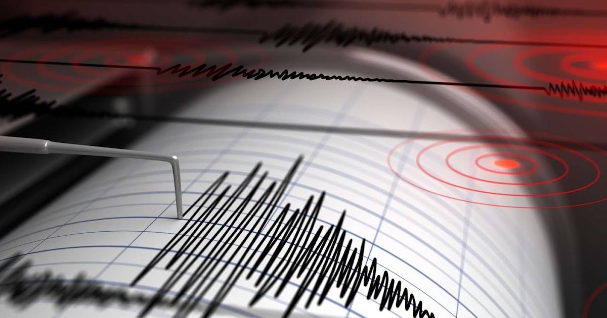
سجلت محطات الشبكة القومية لرصد الزلازل، التابعة للمعهد القومي للبحوث الفلكية والجيوفيزيقية في مصر، هزة أرضية بقوة 6.2 درجة على مقياس ريختر، وقعت على بعد 877 كيلومترا شمال مدينة مرسى مطروح الساحلية، وأكد المعهد أن الهزة وقعت بعيدا عن السواحل المصرية، ولم يشعر بها السكان ولم ترد أي تقارير تفيد بوقوع خسائر في الأرواح أو الممتلكات.
ووفقا لبيان المعهد القومي للبحوث الفلكية، تم تسجيل الهزة في تمام الساعة 7:53 مساء بالتوقيت المحلي، عند خط عرض 39.19 شمالا وخط طول 28.09 شرقا، وعلى عمق 10.90 كيلومتر، وذلك في نفس توقيت الزلزال الذي ضرب إحدى ولايات شمال غربي تركيا بقوة 6.1 درجة على مقياس ريختر، وشعر به السكان على بعد نحو 200 كيلومتر في إسطنبول.
وأشار البيان إلى أن الموقع الجغرافي للهزة يقع ضمن منطقة نشاط زلزالي معروفة في البحر المتوسط، بالقرب من منطقة الحدود التكتونية بين الصفيحة الأفريقية والأوراسية، التي تعد من المناطق النشطة زلزاليا.
وتتمتع مصر بموقع جيولوجي مستقر نسبيا، حيث تقع على الصفيحة الأفريقية، بعيدا عن مناطق الصدوع النشطة مثل حزام الزلازل الممتد في تركيا أو إيران، ومع ذلك تشهد مناطق شمال مصر خصوصا الساحل الشمالي والمناطق القريبة من البحر المتوسط، هزات أرضية عرضية بسبب قربها من مناطق التفاعل التكتوني.
وتعد مصر رائدة إقليميا وعالميا في رصد الزلازل، حيث تمتلك الشبكة القومية لرصد الزلازل، التابعة للمعهد القومي للبحوث الفلكية والجيوفيزيقية تاريخا يمتد لأكثر من 150 عاما، ويعود الأرشيف الزلزالي المصري إلى أكثر من 5000 سنة، مستفيدا من سجلات الحضارة المصرية القديمة التي وثقت الظواهر الطبيعية في كتب التاريخ.
ويعد زلزال 1992 الذي ضرب القاهرة من أبرز الزلازل في تاريخ مصر الحديث وكان بقوة 5.8 درجة وتسبب في أضرار مادية وخسائر محدودة في الأرواح، منذ ذلك الحين تعمل الحكومة على تعزيز البنية التحتية المقاومة للزلازل وبرامج التوعية العامة.
The stations of the National Network for Earthquake Monitoring, affiliated with the National Institute for Astronomical and Geophysical Research in Egypt, recorded an earthquake with a magnitude of 6.2 on the Richter scale, which occurred 877 kilometers north of the coastal city of Marsa Matrouh. The institute confirmed that the tremor occurred far from the Egyptian coasts, and residents did not feel it, with no reports indicating any loss of life or property.
According to a statement from the National Institute for Astronomical Research, the tremor was recorded at exactly 7:53 PM local time, at a latitude of 39.19° North and a longitude of 28.09° East, at a depth of 10.90 kilometers. This coincided with the timing of an earthquake that struck one of the states in northwestern Turkey with a magnitude of 6.1 on the Richter scale, which was felt by residents about 200 kilometers away in Istanbul.
The statement indicated that the geographic location of the tremor falls within a known seismic activity area in the Mediterranean Sea, near the tectonic boundary between the African and Eurasian plates, which is considered one of the seismically active regions.
Egypt enjoys a relatively stable geological position, as it lies on the African plate, far from active fault zones like the earthquake belt extending in Turkey or Iran. However, northern Egypt, particularly the northern coast and areas close to the Mediterranean Sea, experiences occasional tremors due to its proximity to tectonic interaction zones.
Egypt is a regional and global leader in earthquake monitoring, as the National Network for Earthquake Monitoring, affiliated with the National Institute for Astronomical and Geophysical Research, has a history spanning over 150 years. The Egyptian seismic archive dates back over 5,000 years, benefiting from records of ancient Egyptian civilization that documented natural phenomena in historical texts.
The 1992 earthquake that struck Cairo is one of the most significant earthquakes in modern Egyptian history, with a magnitude of 5.8, causing material damage and limited loss of life. Since then, the government has been working to enhance earthquake-resistant infrastructure and public awareness programs.