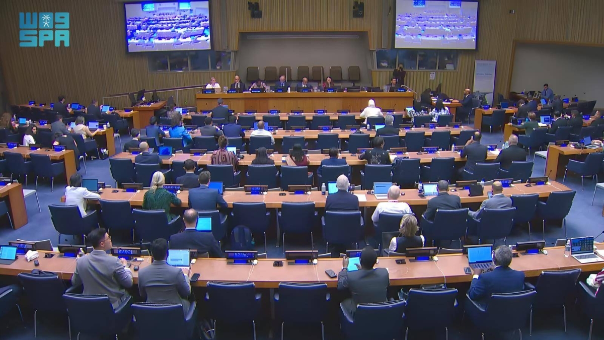
شاركت الهيئة العامة للمساحة والمعلومات الجيومكانية ممثلة للمملكة في أعمال الاجتماع الـ15 للجنة خبراء الأمم المتحدة لإدارة المعلومات الجيومكانية العالمية، المنعقد في مقر الأمم المتحدة بمدينة نيويورك، ورأس وفد المملكة رئيس الهيئة رئيس اللجنة العربية لخبراء الأمم المتحدة لإدارة المعلومات الجيومكانية الدكتور المهندس محمد يحيى آل صايل.
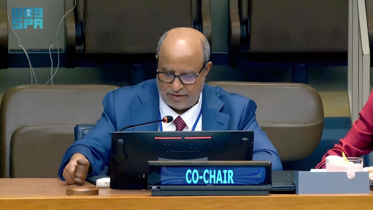
وجرى خلال الجلسة الافتتاحية للاجتماع اختيار آل صايل -من قبل لجنة خبراء الأمم المتحدة لإدارة المعلومات الجيومكانية العالمية- رئيساً مشاركاً (Co-Chair) للجنة خبراء الأمم المتحدة لإدارة المعلومات الجيومكانية العالمية (UN-GGIM)؛ نظير ما تحظى به المملكة من مكانة متقدمة في مصاف نظيراتها من الدول الأخرى في المجال الجيومكاني على المستويين الإقليمي والعالمي، وتتويجاً لمشاركات المملكة الفاعلة ودورها القيادي في المنظمات واللجان والفرق الدولية ذات العلاقة، من ذلك جهودها البارزة ضمن أعمال لجنة خبراء الأمم المتحدة لإدارة المعلومات الجيومكانية العالمية، ورئاستها للجنة العربية لخبراء الأمم المتحدة لإدارة المعلومات الجيومكانية وتولّي أمانتها العامة، واستضافتها مركز الأمم المتحدة العالمي للتميز للمنظومة المستقبلية -للبيئة الحاضنة- للمعلومات الجيومكانية لتكون مدينة الرياض مقراً له، إضافةً إلى عضوية رئيس الجيومكانية عضواً مؤسّساً في اللجنة الاستشارية الدولية لمركز الأمم المتحدة العالمي للتميز للمعرفة والابتكار في الصين، وعضوية الجيومكانية في مركز الأمم المتحدة العالمي للتميز الجيوديسي في ألمانيا.
ويأتي ذلك امتداداً لما للمملكة من تقدم متسارع في المؤشرات والتصنيفات العالمية واستحقاق متتالٍ لعدد من الجوائز الدولية ذات الصلة بالمجال الجيومكاني.
وأشار آل صايل عبر كلمته التي ألقاها في الجلسة الافتتاحية إلى أن ما تحقّق للمملكة في المجال الجيومكاني يُعزى لبالغ الدعم والتمكين اللَذين تحظى بهما جميع القطاعات والمجالات التنموية في المملكة من القيادة الرشيدة؛ مؤكداً سعي الجيومكانية الحثيث لتعزيز هذه الريادة وترسيخها عبر تدعيم التنسيق والتعاون الدوليين ودعم الجهود الدولية لتعزيز دور المعلومات الجيومكانية في تحقيق أهداف التنمية المستدامة، معرباً عن تقديره لثقة لجنة خبراء الأمم المتحدة لإدارة المعلومات الجيومكانية العالمية وشكره للجنة على اختياره رئيساً مشاركاً للجنة خبراء الأمم المتحدة لإدارة المعلومات الجيومكانية (UN-GGIM).
The General Authority for Survey and Geospatial Information represented the Kingdom in the 15th meeting of the United Nations Committee of Experts on Global Geospatial Information Management, held at the United Nations headquarters in New York City. The delegation of the Kingdom was headed by the Chairman of the Authority and the Chairman of the Arab Committee of Experts on United Nations Geospatial Information Management, Dr. Engineer Mohammed Yahya Al-Sail.
During the opening session of the meeting, Al-Sail was elected by the United Nations Committee of Experts on Global Geospatial Information Management as a Co-Chair of the United Nations Committee of Experts on Global Geospatial Information Management (UN-GGIM); in recognition of the Kingdom's advanced position among its peers in the geospatial field at both the regional and global levels, and as a culmination of the Kingdom's active participation and leadership role in relevant international organizations, committees, and teams. This includes its prominent efforts within the works of the United Nations Committee of Experts on Global Geospatial Information Management, its chairmanship of the Arab Committee of Experts on United Nations Geospatial Information Management, and its role in the general secretariat, as well as hosting the United Nations Global Center of Excellence for the Future System - the enabling environment - for geospatial information in Riyadh, in addition to the membership of the geospatial authority as a founding member of the International Advisory Committee of the United Nations Global Center of Excellence for Knowledge and Innovation in China, and the membership of the geospatial authority in the United Nations Global Center of Excellence for Geodesy in Germany.
This comes as an extension of the Kingdom's rapid progress in global indicators and rankings and its consecutive merits for several international awards related to the geospatial field.
Al-Sail indicated in his speech delivered during the opening session that the achievements made by the Kingdom in the geospatial field are attributed to the significant support and empowerment that all sectors and developmental fields in the Kingdom receive from the wise leadership; emphasizing the geospatial authority's diligent efforts to enhance and solidify this leadership through strengthening international coordination and cooperation and supporting international efforts to enhance the role of geospatial information in achieving sustainable development goals. He expressed his appreciation for the trust of the United Nations Committee of Experts on Global Geospatial Information Management and thanked the committee for selecting him as a Co-Chair of the United Nations Committee of Experts on Global Geospatial Information Management (UN-GGIM).