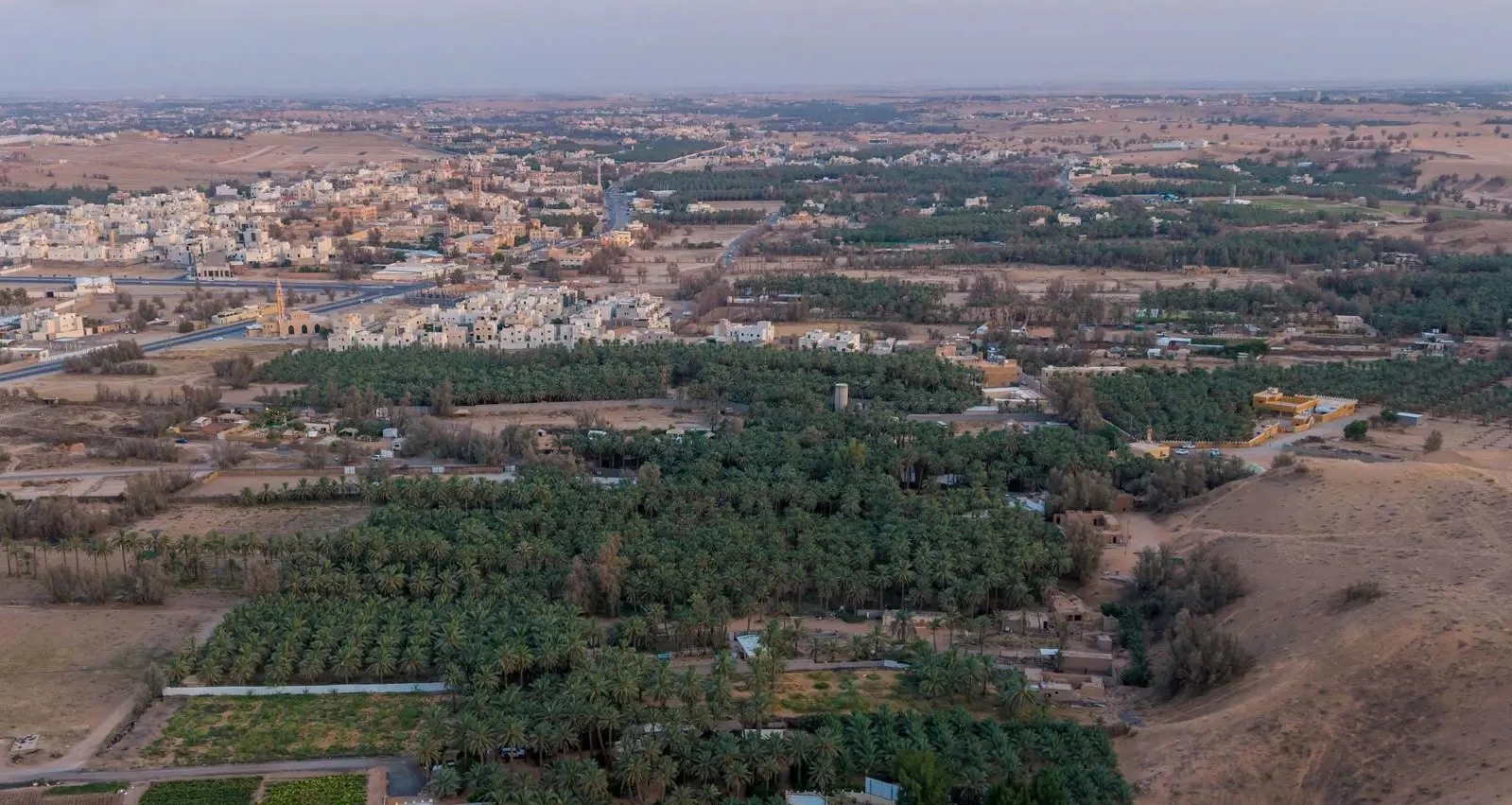
نشأت «خبوب بريدة» لتشكّل على مدى أزمنة متعاقبة جزءاً من ذاكرة المكان في منطقة القصيم وتجسّد علاقة الإنسان بأرضه، وذلك بين كثبان الرمال ومواضع الماء والزراعة، بعد أن تحولت منخفضاتها إلى بيئات للزراعة والاستقرار، فنشأت المزارع والآبار والمساكن وتكوّنت حولها تجمعات سكانية قبل أن يصل إليها الامتداد العمراني وتتغير ملامح عدد منها، فيما بقيت أسماؤها شاهدة على تاريخ المكان وتحولاته.
دلالة جغرافية
يحمل مسمى «الخبوب»، وهو جمع خَبّ، دلالة جغرافية ارتبطت بطبيعة الأرض، ويُطلق محلياً على المنخفضات الواقعة بين الكثبان أو العروق الرملية، التي أسهمت خصائصها الطبيعية وتوافر المياه فيها في تهيئة بيئة ملائمة للزراعة والاستقرار، فحفر الإنسان الآبار، وغرس النخيل، وزرع المحاصيل، وأقام مساكنه بالقرب من مصادر المياه. وانتشرت الخبوب في مواقع عدة حول بريدة، ولا سيما في جهاتها الغربية والجنوبية والشمالية الغربية، وأسهمت طبيعة الأرض وموارد المياه في استثمارها زراعياً، وكان الماء محور الحياة فيها؛ إذ اعتمد الأهالي على الآبار المعروفة محلياً بـ«القلبان» في الشرب وري المزارع، فيما شكّلت النخلة أحد أبرز مكونات المشهد الزراعي، إلى جانب الحبوب والخضروات والأعلاف.
عناصر أساسية
ومن الماء والزراعة تشكّل الاستقرار؛ فأقيمت المساكن بالقرب من المزارع والآبار، وأصبحت المزرعة والبئر والمنزل والمسجد عناصر أساسية في حياة السكان، وارتبطت تفاصيل حياتهم بمواسم الري والزراعة والحصاد وجني التمور، وقامت بينهم علاقات الجوار والتعاون والمشاركة، لتغدو الخبوب فضاءات للسكن والعمل والحياة الاجتماعية.
مراحل تاريخية مختلفة
وكان للخبوب دور في النشاط الاقتصادي لبريدة ومحيطها، بما وفرته من منتجات زراعية وجدت طريقها إلى الأسواق، وأسهمت في إيجاد صلة بين مناطق الإنتاج والحركة التجارية، بما يعكس مكانة الزراعة في الحياة الاقتصادية للمدينة خلال مراحل تاريخية مختلفة. ومع اتساع الاستقرار، تعددت الخبوب ومسمياتها، ولم تكن أسماؤها مجرد مسميات مكانية، بل ارتبطت بسكانها ومزارعها وآبارها ومساجدها وطرقها، وظل عدد منها حاضراً في الذاكرة المحلية بما يحمله من دلالات جغرافية واجتماعية.
The "Khubub of Buraidah" emerged to form, over successive times, a part of the memory of the place in the Al-Qassim region and embodies the relationship between humans and their land, amidst sand dunes and water and agricultural sites, after its depressions transformed into environments for agriculture and settlement. Farms, wells, and homes were established, and population clusters formed around them before urban expansion reached them and altered the features of some, while their names remained as witnesses to the history of the place and its transformations.
Geographical Significance
The term "Khubub," which is the plural of "Khab," carries a geographical significance linked to the nature of the land. It is locally used to refer to the depressions located between dunes or sandy ridges, whose natural characteristics and availability of water contributed to creating a suitable environment for agriculture and settlement. Humans dug wells, planted date palms, cultivated crops, and built their homes near water sources. The khubub spread in several locations around Buraidah, especially in its western, southern, and northwestern directions. The nature of the land and water resources contributed to its agricultural investment, with water being the center of life there; the locals relied on wells known locally as "Al-Qurban" for drinking and irrigating farms, while the date palm became one of the most prominent components of the agricultural scene, alongside grains, vegetables, and fodder.
Essential Elements
From water and agriculture, stability was formed; homes were built near farms and wells, and the farm, well, house, and mosque became essential elements in the lives of the residents. The details of their lives were linked to the seasons of irrigation, agriculture, harvesting, and date picking, fostering relationships of neighborliness, cooperation, and sharing among them, making the khubub spaces for living, working, and social life.
Different Historical Stages
The khubub played a role in the economic activity of Buraidah and its surroundings, providing agricultural products that found their way to markets and contributing to establishing a connection between production areas and commercial movement, reflecting the status of agriculture in the economic life of the city during different historical stages. As stability expanded, the khubub and their names multiplied; their names were not merely spatial designations but were linked to their inhabitants, farms, wells, mosques, and roads, with some of them remaining present in local memory due to their geographical and social connotations.