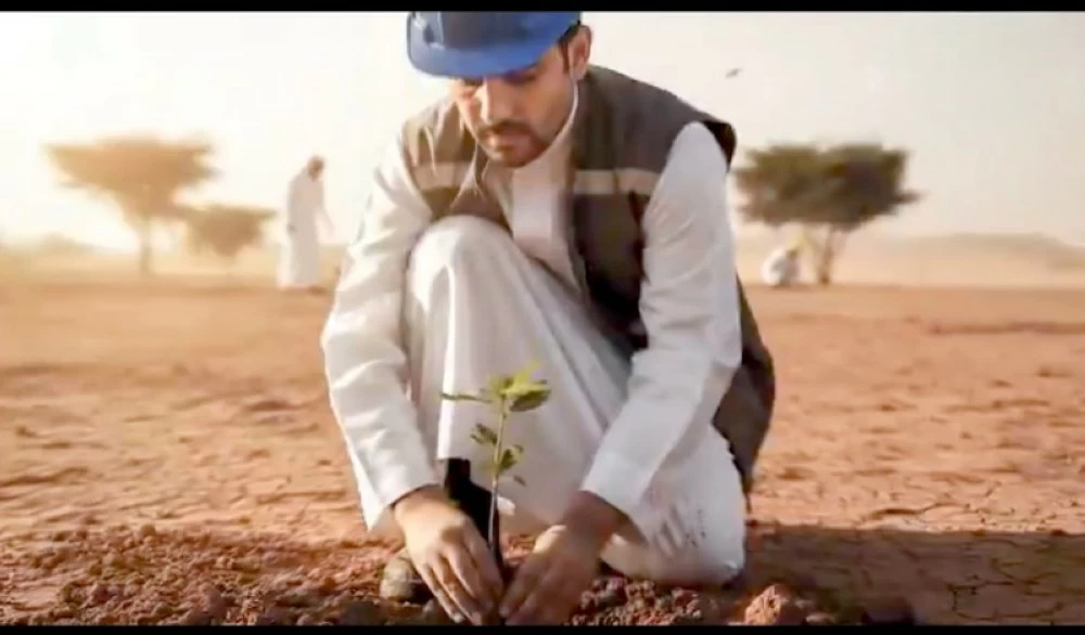
أكد البرنامج الوطني للتشجير، أهمية الأقاليم النباتية في بناء قاعدة معرفية وطنية تُسهم في تعزيز التخطيط البيئي، ودعم التنمية المستدامة، مشيرًا إلى أن خريطة الأقاليم النباتية تُعد من أهم المشاريع الإستراتيجية التي يعمل عليها البرنامج، للإسهام في توجيه الجهود البيئية بدقة أعلى، بما يتماشى مع مستهدفات رؤية المملكة 2030، لتحقيق الاستدامة البيئية، وذلك خلال ورشة العمل التي نظّمها البرنامج أمس بالرياض؛ لاستعراض مسودة مشروع خريطة الأقاليم النباتية في المملكة، ودورها في التخطيط البيئي ومشاريع التشجير، بمشاركة عددٍ من الجهات الحكومية والخاصة، والمختصين في مجال البيئة.
وأوضح الرئيس التنفيذي للمركز الوطني لتنمية الغطاء النباتي ومكافحة التصحر المهندس أحمد العيادة، أن خريطة الأقاليم النباتية ترسم ملامح المستقبل البيئي للمملكة، وتُشكّل مرجعًا شاملًا ودقيقًا يمكن الاستفادة منه للباحثين والمخططين والجهات التنفيذية من خلال ربطها إلكترونيًا بالمنصة الوطنية للتشجير؛ بحيث يمكن الوصول إليها في أي وقت ومن أي مكان، مبينًا أن الأقاليم النباتية تُعد مدخلًا مهمًا لمنصة التشجير، التي تُمثّل قناة رسمية لتوثيق وتسجيل الأشجار التي تُزْرَع في النطاقات المختلفة، بما يحقق التوازن البيئي, والاستفادة من الأشجار المناسبة في بيئاتها الأصلية.
وأبان المهندس العيادة، أن التوصيف النباتي لهذه الأقاليم يُمثّل خطوة أساسية لتمكين الجهات المعنية من اتخاذ قراراتٍ أفضل، وأكثر اتساقًا مع المعطيات الطبيعية؛ ما يعزز استدامة الموارد البيئية، ويُسهم في مكافحة التصحر واستعادة الأراضي، إضافةً إلى تحسين إدارة المراعي والغابات، وتطوير المشاتل وخطط إنتاج الشتلات، ودعم مبادرات التشجير، إلى جانب التخطيط الأمثل لاستخدامات الأراضي.
وأفاد، أن مشروع خريطة الأقاليم النباتية اعتمد على منهجية علمية متقدمة تقوم على تحليلٍ متعدد الطبقات للبيانات النباتية والمناخية والمكانية، إلى جانب العمل الميداني الذي أكد صحة البيانات، وسمح باختيار المواقع التمثيلية المناسبة للتحليل النهائي، مشيرًا إلى أن تلك الجهود أثمرت عن تحديد 21 إقليمًا بيئيًا تعكس تباينًا واضحًا في الأنظمة الطبيعية، بما يمنح صورةً دقيقةً عن ثراء وتنوّع بيئة المملكة.
The National Afforestation Program emphasized the importance of plant regions in building a national knowledge base that contributes to enhancing environmental planning and supporting sustainable development. It pointed out that the map of plant regions is one of the most important strategic projects being worked on by the program to help direct environmental efforts with greater precision, in line with the objectives of the Kingdom's Vision 2030, to achieve environmental sustainability. This was stated during the workshop organized by the program yesterday in Riyadh to review the draft project of the map of plant regions in the Kingdom and its role in environmental planning and afforestation projects, with the participation of several government and private entities, as well as specialists in the field of environment.
The CEO of the National Center for Vegetation Cover Development and Combating Desertification, Engineer Ahmed Al-Ayada, explained that the map of plant regions outlines the environmental future of the Kingdom and serves as a comprehensive and accurate reference that can be utilized by researchers, planners, and executive bodies by linking it electronically to the national afforestation platform, allowing access at any time and from anywhere. He indicated that plant regions are an important entry point for the afforestation platform, which represents an official channel for documenting and recording the trees planted in various areas, achieving ecological balance and benefiting from suitable trees in their native environments.
Engineer Al-Ayada further clarified that the botanical description of these regions represents a fundamental step to enable the concerned parties to make better decisions that are more consistent with natural data, thereby enhancing the sustainability of environmental resources and contributing to combating desertification and restoring lands, in addition to improving the management of pastures and forests, developing nurseries and seedling production plans, and supporting afforestation initiatives, along with optimal planning for land uses.
He noted that the project of the map of plant regions relied on an advanced scientific methodology based on multi-layered analysis of botanical, climatic, and spatial data, in addition to fieldwork that confirmed the validity of the data and allowed for the selection of suitable representative sites for the final analysis. He pointed out that these efforts resulted in the identification of 21 ecological regions that reflect a clear variation in natural systems, providing an accurate picture of the richness and diversity of the Kingdom's environment.