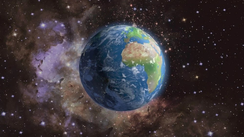
كشف علماء في وكالة ناسا أن مركز كتلة الأرض يتحرك باستمرار بمقدار بضعة مليمترات حول مركزها الهندسي، نتيجة التغيرات الموسمية في توزيع المياه والجليد والهواء على سطح الكوكب.
وأوضح العلماء أن ذوبان الثلوج وتساقط الأمطار وتغير كميات المياه في المحيطات، إلى جانب التغيرات الموسمية في الغلاف الجوي، تعيد توزيع كتل هائلة من المياه والهواء بين مناطق مختلفة من الأرض، ما يؤدي إلى تذبذب مركز كتلة الكوكب على مدار العام.
ويقصد بمركز كتلة الأرض، أو "الجيوسنتر"، النقطة التي تتجمع حولها كتلة نظام الأرض، وهو مرجع أساسي في عمليات الرصد والقياس الفضائي وتحديد المواقع. ورغم أن حركة هذه النقطة لا تتجاوز بضعة مليمترات، فإنها تصبح مهمة عندما يتعلق الأمر بقياسات فائقة الدقة تعتمد عليها الملاحة ورسم الخرائط ومراقبة التغيرات على سطح الأرض.
وقال فيليكس لاندرر، الباحث في مختبر الدفع النفاث التابع لناسا وأحد المشاركين في الدراسة، إن هذه التحركات تبدو صغيرة، لكن العالم الحديث يعتمد على قياسات شديدة الدقة لتحديد المواقع، وهو ما يجعل فهم التغيرات التي تطرأ على أنظمة الإسناد الجغرافي أمراً مهماً لتحسين الملاحة ورسم الخرائط.
وفي الدراسة الجديدة، التي نشرت في Geophysical Journal International، طور الباحث دونالد أرغوس وفريقه طريقة جديدة لتحديد حركة مركز كتلة الأرض بدقة أعلى، من خلال الجمع بين بيانات التتبع فائق الدقة للأقمار الصناعية وبيانات نظام تحديد المواقع العالمي "GPS"، إلى جانب بيانات أقمار صناعية أخرى تدور في مدارات أرضية منخفضة.
وتستفيد الطريقة الجديدة من حقيقة أن الأقمار الصناعية تدور حول مركز كتلة الأرض، بحيث يمكن رصد التغيرات الصغيرة في المسافات بينها وبين المحطات الأرضية لتحديد حركة هذا المركز بدقة أكبر. كما يأخذ النموذج في الاعتبار تأثير وزن المياه والجليد في تشوه القشرة الأرضية وحركة محطات الرصد نفسها.
وأظهرت النتائج أن حركة مركز كتلة الأرض تتغير بانتظام مع الفصول. ففي مارس، يصل تراكم الثلوج في أمريكا الشمالية وأوراسيا إلى ذروته، ما يدفع مركز الكتلة بنحو 3 مليمترات باتجاه القطب الشمالي.
وفي أبريل، تبلغ مياه الأمطار المخزنة في حوض نهر الأمازون ذروتها عند نحو 2400 غيغا طن، وهو ما يؤدي إلى تحرك مركز الكتلة بنحو 2.2 مليمتر باتجاه أمريكا الجنوبية. وفي نوفمبر، تضيف مياه الرياح الموسمية في جنوب شرق آسيا، التي تصل إلى نحو 600 غيغا طن، تأثيراً إضافياً وإن كان أصغر على التذبذب السنوي.
كما تؤدي المحيطات والغلاف الجوي دوراً في هذا التذبذب، إذ تنتقل كميات ضخمة من المياه والهواء بين نصفي الكرة الأرضية خلال العام. ووجد الباحثون أن الهواء الشتوي البارد والكثيف يغير توزيع الكتلة في مناطق مختلفة من الكوكب، بينما تسهم مياه الأمطار وذوبان الجليد في تغييرات موسمية أخرى.
والمفارقة أن الدراسة الجديدة تشير إلى أن حجم حركة مركز كتلة الأرض أقل مما كان يعتقد سابقاً؛ إذ قدر الباحثون أن مقدار الحركة السنوية ذهاباً وإياباً يبلغ نحو نصف التقديرات التي كانت سائدة قبل ثماني سنوات.
وقال أرغوس إن النتائج تشير إلى أن كمية المياه والهواء التي تنتقل بين نصفي الكرة الأرضية موسميًا أقل مما كان مقدراً في السابق.
ولا تقتصر تأثيرات إعادة توزيع الكتلة على مركز الأرض، إذ يمكن أن تؤثر أيضاً في حركة محور القطبين.
وتتابع ناسا هذه التغيرات باستخدام مجموعة من تقنيات الرصد الفضائي والأرضي، إلى جانب بيانات مهمة GRACE-FO التي تقيس التغيرات في مجال جاذبية الأرض الناتجة بصورة رئيسية عن حركة المياه فوق الأرض وتحتها.
وتكتسب هذه القياسات أهمية متزايدة مع التغيرات المناخية، خصوصاً ذوبان الصفائح والأنهار الجليدية، إذ يمكن لإعادة توزيع الكتلة الناتجة عن هذه العمليات أن تؤثر في حركة الأقطاب وفي القياسات الجيوديسية المستخدمة لرصد تغيرات الأرض.
وبحسب ناسا، فإن أهمية النتائج لا تكمن في وجود خطر مباشر على مستخدمي أنظمة الملاحة، وإنما في تحسين دقة "إطار الإسناد الأرضي" الذي تعتمد عليه أنظمة تحديد المواقع والقياسات الفضائية. وكلما أصبحت هذه الأنظمة أكثر دقة، بات من الضروري أخذ التحركات الصغيرة في مركز كتلة الأرض في الاعتبار.
NASA scientists have revealed that the center of mass of the Earth is constantly moving by a few millimeters around its geometric center, due to seasonal changes in the distribution of water, ice, and air on the planet's surface.
The scientists explained that the melting of snow, rainfall, and changes in the amounts of water in the oceans, along with seasonal changes in the atmosphere, redistribute massive amounts of water and air between different regions of the Earth, causing the center of mass of the planet to fluctuate throughout the year.
The center of mass of the Earth, or "geocenter," refers to the point around which the mass of the Earth system gathers, and it is a fundamental reference in space observation, measurement, and positioning. Although the movement of this point does not exceed a few millimeters, it becomes significant when it comes to ultra-precise measurements that navigation, mapping, and monitoring changes on the Earth's surface depend on.
Felix Landerer, a researcher at NASA's Jet Propulsion Laboratory and one of the study participants, stated that these movements may seem small, but the modern world relies on highly accurate measurements for positioning, which makes understanding the changes occurring in geographic reference systems important for improving navigation and mapping.
In the new study, published in the Geophysical Journal International, researcher Donald Argus and his team developed a new method to determine the movement of the Earth's center of mass with higher precision by combining ultra-precise tracking data from satellites with Global Positioning System (GPS) data, along with data from other satellites in low Earth orbits.
The new method takes advantage of the fact that satellites orbit around the Earth's center of mass, allowing for the observation of small changes in distances between them and ground stations to determine the movement of this center more accurately. The model also accounts for the effect of the weight of water and ice on the deformation of the Earth's crust and the movement of the observation stations themselves.
The results showed that the movement of the Earth's center of mass changes regularly with the seasons. In March, the accumulation of snow in North America and Eurasia reaches its peak, pushing the center of mass about 3 millimeters toward the North Pole.
In April, the stored rainfall in the Amazon River basin peaks at around 2400 gigatons, leading to a movement of the center of mass about 2.2 millimeters toward South America. In November, the addition of monsoon waters in Southeast Asia, which amount to about 600 gigatons, has an additional, albeit smaller, effect on the annual fluctuation.
The oceans and atmosphere also play a role in this fluctuation, as massive amounts of water and air move between the hemispheres throughout the year. Researchers found that cold, dense winter air alters the mass distribution in different regions of the planet, while rainfall and melting ice contribute to other seasonal changes.
Ironically, the new study indicates that the magnitude of the movement of the Earth's center of mass is less than previously thought; researchers estimated that the annual back-and-forth movement is about half of the estimates that were prevalent eight years ago.
Argus stated that the results suggest that the amount of water and air that moves between the hemispheres seasonally is less than previously estimated.
The effects of mass redistribution are not limited to the center of the Earth; they can also affect the movement of the poles' axis.
NASA monitors these changes using a range of space and ground observation techniques, along with the important GRACE-FO data that measures changes in the Earth's gravitational field primarily caused by the movement of water above and below the Earth's surface.
These measurements gain increasing importance with climate changes, especially the melting of ice sheets and glaciers, as the mass redistribution resulting from these processes can affect the movement of the poles and the geodetic measurements used to monitor changes on Earth.
According to NASA, the significance of the results does not lie in a direct threat to users of navigation systems, but rather in improving the accuracy of the "terrestrial reference frame" that navigation and space measurement systems rely on. As these systems become more precise, it becomes essential to consider the small movements of the Earth's center of mass.