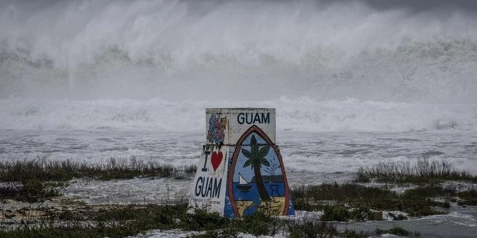
أعلنت هيئة الأرصاد الجوية الفلبينية أنها تتابع عن كثب تحركات الإعصار الفائق «بافي»، الذي يواصل اقترابه من البلاد، وسط توقعات بدخوله منطقة المسؤولية الفلبينية خلال الأيام القادمة، في وقت حذرت من مخاطر الأمطار الغزيرة والفيضانات والانهيارات الأرضية.
وقالت الهيئة، في بيان، إن الإعصار كان يتمركز صباح السبت على بعد نحو 2645 كيلومتراً شرق منطقة إيسترن فيساياس، ويتحرك غرباً بسرعة 10 كيلومترات في الساعة، مصحوباً برياح مستدامة تبلغ سرعتها 195 كيلومتراً في الساعة، بينما تصل سرعة هبات الرياح إلى 240 كيلومتراً في الساعة.
وأوضحت أن أحدث التوقعات تشير إلى احتمال دخول الإعصار منطقة المسؤولية الفلبينية بحلول منتصف الأسبوع القادم، مع ترجيحات بمروره بالقرب من أقصى شمال البلاد، دون مؤشرات مؤكدة حتى الآن على وصوله إلى اليابسة، مؤكدة أن مساره وشدته لا يزالان عرضة للتغير خلال الأيام القادمة.
وفي موازاة ذلك، توقعت هيئة الأرصاد هطول أمطار على عدد من المناطق نتيجة تأثير الرياح الشرقية والعواصف الرعدية المحلية، من بينها وادي كاجايان، وإقليم بيكول، وشرق فيساياس، وأورورا، وكويزون، وجزر ديناجات.
وحذرت السلطات سكان هذه المناطق من احتمال وقوع فيضانات مفاجئة وانهيارات أرضية خلال العواصف الرعدية الشديدة، داعية إلى متابعة النشرات الجوية الرسمية والالتزام بالإرشادات الوقائية والاستعداد لأي تطورات محتملة مع استمرار مراقبة مسار الإعصار.
وتُعد الفلبين من أكثر دول العالم تعرضاً للأعاصير المدارية، نظراً لموقعها في غرب المحيط الهادئ، إذ يمر عبرها أو يقترب منها سنوياً نحو 20 إعصاراً وعاصفة مدارية، يتسبب عدد منها في خسائر بشرية ومادية كبيرة.
وتقوم هيئة الأرصاد الجوية الفلبينية بمتابعة الأعاصير منذ مراحلها الأولى، وتصدر تحذيرات مبكرة للسكان والسلطات المحلية، خصوصاً مع إمكانية تغير مسارات الأعاصير أو اشتداد قوتها بشكل سريع، وهو ما يجعل الاستعداد المبكر والإخلاء الوقائي من أهم وسائل الحد من آثار الكوارث الطبيعية في البلاد.
The Philippine Atmospheric, Geophysical and Astronomical Services Administration (PAGASA) announced that it is closely monitoring the movements of the super typhoon "Bavi," which continues to approach the country, amid expectations of its entry into the Philippine area of responsibility in the coming days, while warning of the risks of heavy rains, flooding, and landslides.
The agency stated in a statement that the typhoon was centered on Saturday morning about 2,645 kilometers east of the Eastern Visayas region, moving west at a speed of 10 kilometers per hour, accompanied by sustained winds of 195 kilometers per hour, while gusts can reach 240 kilometers per hour.
It clarified that the latest forecasts indicate the possibility of the typhoon entering the Philippine area of responsibility by mid-next week, with expectations of it passing near the northernmost part of the country, without any confirmed indications yet of it making landfall, emphasizing that its path and intensity remain subject to change in the coming days.
In parallel, the weather agency predicted rainfall in several areas due to the influence of easterly winds and local thunderstorms, including the Cagayan Valley, the Bicol region, Eastern Visayas, Aurora, Quezon, and the Dinagat Islands.
The authorities warned residents of these areas of the possibility of sudden flooding and landslides during severe thunderstorms, urging them to follow official weather updates and adhere to preventive guidelines and to be prepared for any potential developments while continuing to monitor the typhoon's path.
The Philippines is one of the most typhoon-prone countries in the world, due to its location in the western Pacific Ocean, with about 20 typhoons and tropical storms passing through or approaching it annually, some of which cause significant human and material losses.
The Philippine Atmospheric, Geophysical and Astronomical Services Administration monitors typhoons from their early stages and issues early warnings to residents and local authorities, especially with the possibility of changes in the paths of typhoons or a rapid increase in their strength, making early preparedness and precautionary evacuation some of the most important means to mitigate the effects of natural disasters in the country.