في اكتشاف مذهل يكشف أسرار الماضي، عثر العلماء على منظر طبيعي قديم مدفون تحت أكثر من ميل من الجليد في شرق القارة القطبية الجنوبية، وفقًا لصحيفية mail online.
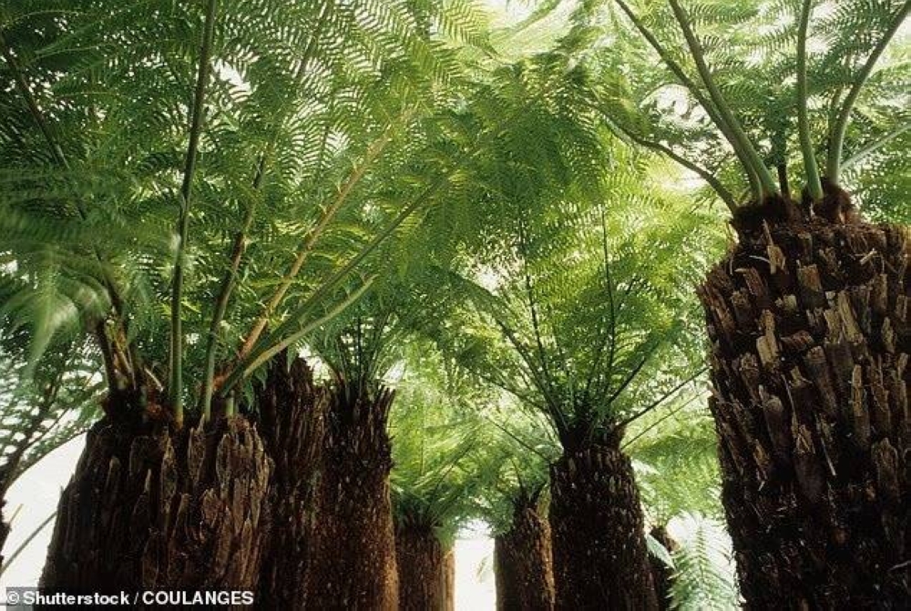
هذا العالم المخفي، الذي لم تمسه يد التغيير منذ 34 مليون سنة، يروي قصة أنهار جارية وغابات كثيفة ربما زينتها أشجار النخيل.
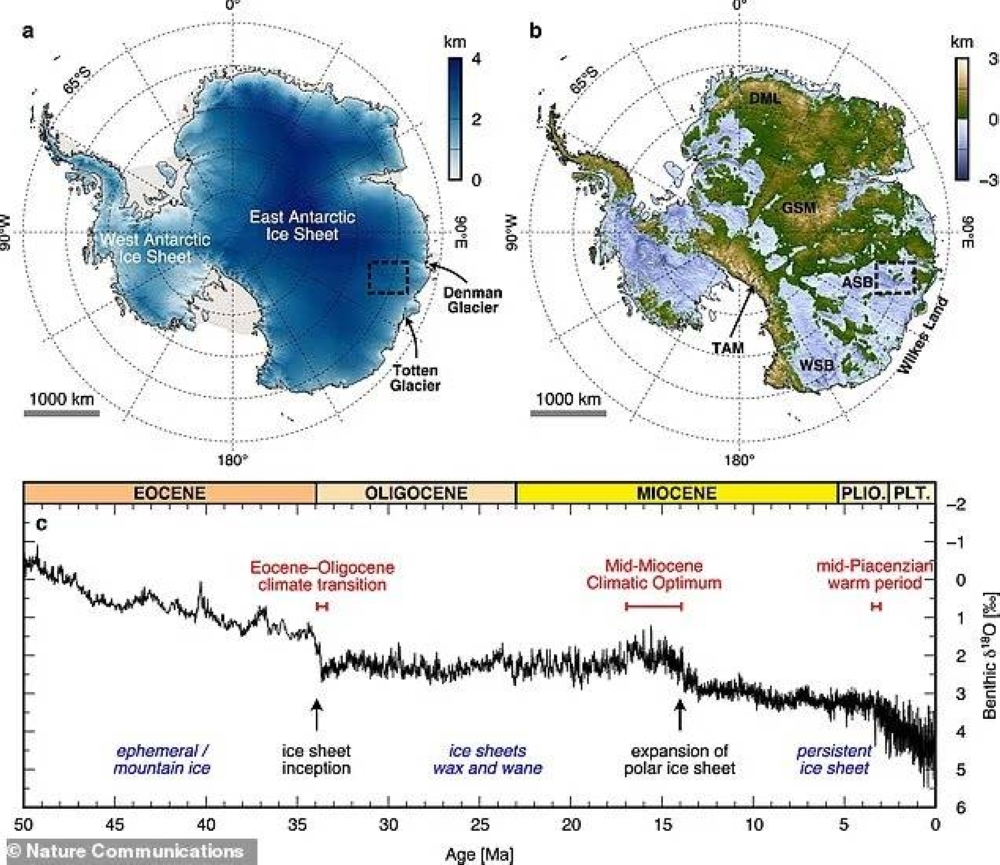
في منطقة ويلكس لاند النائية (في مواجهة جنوب المحيط الهندي)، يفتح هذا الاكتشاف نافذة نادرة على ماضي القارة القطبية قبل أن تتحول إلى صحراء جليدية، مما يثير تساؤلات حول مستقبلها في ظل تغير المناخ.
واستخدم الباحثون بيانات الأقمار الصناعية والرادار المخترق للجليد للكشف عن هذا المنظر الذي يمتد على 12,000 ميل مربع، بحجم ولاية ماريلاند الأمريكية.
ويتكون من ثلاث كتل أرضية مرتفعة، يتراوح طولها بين 75 و105 أميال، تفصلها وديان عميقة تصل إلى 3900 قدم.
ويقول البروفيسور ستيوارت جيميسون من جامعة دورحم، قائد الدراسة: إنه كبسولة زمنية تكشف عن تاريخ القارة القطبية.
هذا المنظر، الذي تشكل قبل تكون الأنهار الجليدية، ظل محفوظًا بفضل الجليد البارد الذي يتحرك ببطء شديد، أقل من 16 قدمًا سنويًا، مما يحد من التعرية.
وتشير الدراسة إلى أن القارة القطبية كانت ذات يوم موطنًا لأنهار وغابات في مناخ معتدل، قبل أن يؤدي تحرك القارات وانخفاض مستويات ثاني أكسيد الكربون إلى تكوّن صفائح جليدية ضخمة.
ومنذ 14 مليون سنة غطى الجليد هذه المنطقة، وحتى خلال الفترات الدافئة، مثل منتصف العصر البليوسيني، بقيت مدفونة، واستخدم العلماء نماذج حاسوبية لتتبع التغيرات، مكتشفين ارتفاعات تصل إلى 1600 قدم بفعل ضغط الجليد.
يؤكد البروفيسور نيل روس من جامعة نيوكاسل، المشارك في الدراسة، أن هذا الاكتشاف يكشف عن تاريخ الصفيحة الجليدية ويوفر رؤى حول استجابتها لتغير المناخ المستقبلي.
ومع ارتفاع مستويات ثاني أكسيد الكربون اليوم، يحذر العلماء من احتمال تراجع الجليد، لكن الوصول إلى هذا المنظر يتطلب جهودًا هائلة لحفر الجليد، ويخطط الباحثون لمواصلة الاستكشاف لفهم تطور المنظر والجليد على مدى التاريخ الطويل.
In a stunning discovery that reveals secrets of the past, scientists have found an ancient landscape buried under more than a mile of ice in East Antarctica, according to the Mail Online.
This hidden world, untouched by change for 34 million years, tells the story of flowing rivers and dense forests that may have been adorned with palm trees.
In the remote Wilkes Land region (facing the Southern Indian Ocean), this discovery opens a rare window into the continent's past before it turned into an icy desert, raising questions about its future in the face of climate change.
The researchers used satellite data and ice-penetrating radar to reveal this landscape that spans 12,000 square miles, about the size of the U.S. state of Maryland.
It consists of three elevated land masses, ranging from 75 to 105 miles in length, separated by deep valleys reaching up to 3,900 feet.
Professor Stuart Jamieson from Durham University, the study's lead, states that it is a time capsule revealing the history of Antarctica.
This landscape, which formed before the glaciers, has been preserved thanks to the cold ice that moves very slowly, less than 16 feet per year, limiting erosion.
The study suggests that Antarctica was once home to rivers and forests in a temperate climate, before continental drift and declining carbon dioxide levels led to the formation of massive ice sheets.
For the past 14 million years, ice has covered this area, and even during warm periods, such as the mid-Pliocene, it remained buried. Scientists used computer models to track changes, discovering elevations of up to 1,600 feet due to the pressure of the ice.
Professor Neil Ross from Newcastle University, a co-author of the study, confirms that this discovery reveals the history of the ice sheet and provides insights into its response to future climate change.
With carbon dioxide levels rising today, scientists warn of the potential retreat of the ice, but accessing this landscape requires enormous efforts to drill through the ice, and researchers plan to continue exploring to understand the evolution of the landscape and ice throughout history.