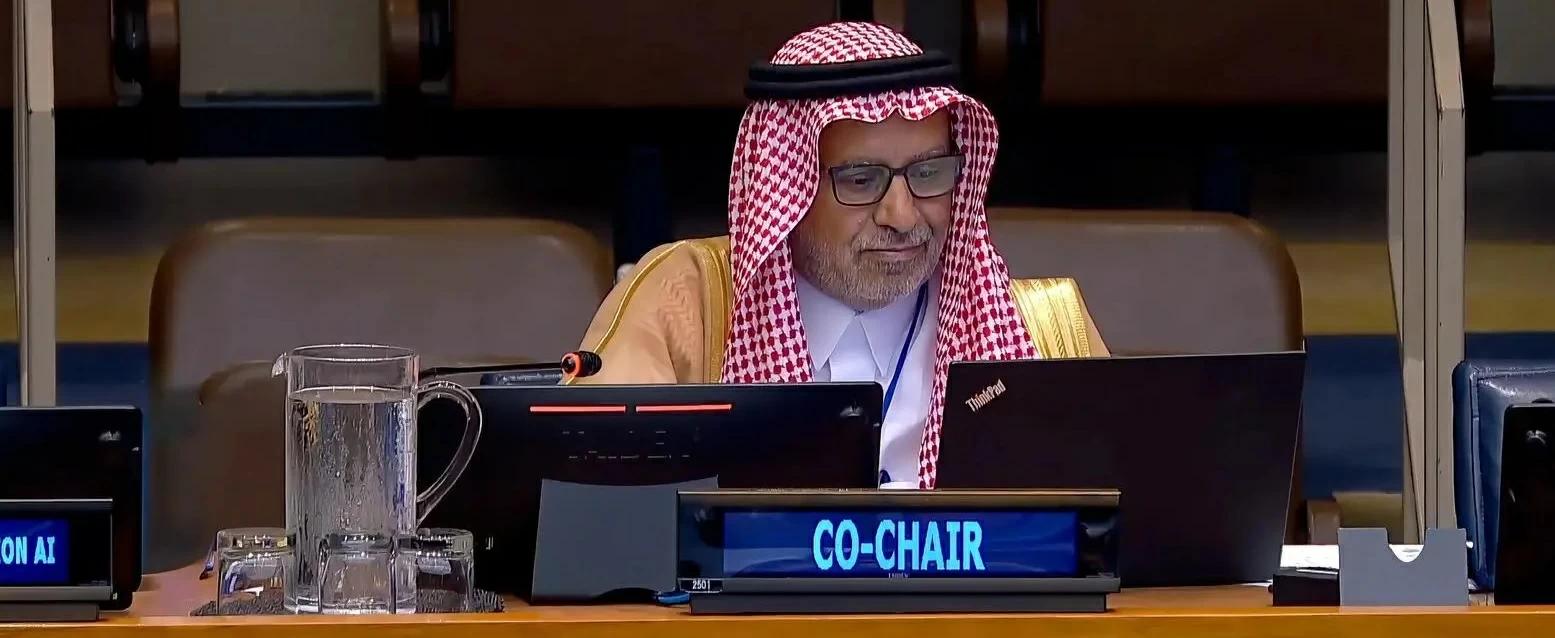
شاركت المملكة العربية السعودية، ممثلةً بالهيئة العامة للمساحة والمعلومات الجيومكانية، في أعمال الاجتماع الـ16 للجنة خبراء الأمم المتحدة لإدارة المعلومات الجيومكانية العالمية (UN-GGIM)، الذي عُقد في مقر الأمم المتحدة بمدينة نيويورك، بمشاركة ممثلي الدول الأعضاء والمنظمات الدولية والجهات ذات العلاقة.
ورأس وفد المملكة رئيس الهيئة العامة للمساحة والمعلومات الجيومكانية الدكتور المهندس محمد بن يحيى آل صايل، مؤكداً أهمية تعزيز التعاون الدولي وتطوير منظومة عالمية متكاملة لإدارة المعلومات الجيومكانية، والاستفادة من التقنيات الحديثة والذكاء الاصطناعي في دعم التنمية المستدامة وصناعة القرار.
واستعرضت المملكة خلال الاجتماع جهودها في تنفيذ إطار الأمم المتحدة المتكامل للمعلومات الجيومكانية (UN-IGIF)، وتطوير السياسات والأطر التنظيمية والمعايير الوطنية للبيانات الجيومكانية، بما يعزز جودتها وتكاملها وقابليتها للتشغيل البيني وتبادلها بكفاءة.
وتناولت مشاركتها عدداً من الموضوعات المرتبطة بمستقبل إدارة المعلومات الجيومكانية، شملت تكامل المعلومات الجيومكانية والإحصائية، وإدارة الأراضي، والمعلومات البحرية والهيدروغرافية، والإطار المرجعي الجيوديسي العالمي، إلى جانب توظيف الذكاء الاصطناعي والتوائم الرقمية والحوسبة السحابية في تطوير القطاع.
وأكدت المملكة دعمها الإطار المرجعي الجيوديسي العالمي، مستعرضةً مساهمتها في مبادرة الإطار المرجعي الجيوديسي العربي (ARABREF)، وجهودها في تطوير البنية التحتية الجيوديسية وبناء القدرات على المستويين الإقليمي والدولي.
وفي مجال الأسماء الجغرافية، أكدت أهمية توحيدها والمحافظة عليها بوصفها مكوناً من مكونات الهوية الوطنية والثقافية، وتطوير قواعد بياناتها وتوظيف التقنيات الحديثة في إدارتها، بما يحافظ على الخصوصية الثقافية واللغوية ويدعم سيادة البيانات.
واستعرضت المملكة آخر التطورات المتعلقة بإنشاء مركز الأمم المتحدة للتميز الجيومكاني (Ecosystem) في الرياض، ليكون منصة للابتكار وتبادل المعرفة وتقديم الدعم الفني للدول الأعضاء، بالتكامل مع مركزي الأمم المتحدة الجيومكانيين في بون بألمانيا وديتشينغ بالصين.
وفي ختام المشاركة، دعا رئيس الهيئة الدول الأعضاء والمشاركين إلى حضور مؤتمر الأمم المتحدة العالمي الثالث للمعلومات الجيومكانية (UNWGIC 2026)، الذي تستضيفه المملكة في جدة خلال الفترة من 16 حتى 19 نوفمبر القادم، مؤكداً أن الاستعدادات لاستضافته تسير وفق الخطط الموضوعة.
The Kingdom of Saudi Arabia, represented by the General Authority for Survey and Geospatial Information, participated in the 16th meeting of the United Nations Committee of Experts on Global Geospatial Information Management (UN-GGIM), which was held at the United Nations headquarters in New York City, with the participation of representatives from member states, international organizations, and relevant entities.
The delegation of the Kingdom was headed by the Chairman of the General Authority for Survey and Geospatial Information, Dr. Engineer Mohammed bin Yahya Al-Sail, who emphasized the importance of enhancing international cooperation and developing a comprehensive global system for geospatial information management, as well as leveraging modern technologies and artificial intelligence to support sustainable development and decision-making.
During the meeting, the Kingdom reviewed its efforts in implementing the United Nations Integrated Geospatial Information Framework (UN-IGIF), and developing policies, regulatory frameworks, and national standards for geospatial data, which enhance its quality, integration, interoperability, and efficient exchange.
Its participation addressed several topics related to the future of geospatial information management, including the integration of geospatial and statistical information, land management, marine and hydrographic information, and the global geodetic reference framework, in addition to employing artificial intelligence, digital twins, and cloud computing in developing the sector.
The Kingdom affirmed its support for the global geodetic reference framework, showcasing its contribution to the Arab Geodetic Reference Framework (ARABREF) initiative, and its efforts in developing geodetic infrastructure and building capacities at both regional and international levels.
In the field of geographic names, it emphasized the importance of standardizing and preserving them as a component of national and cultural identity, developing databases for them, and utilizing modern technologies in their management, while maintaining cultural and linguistic privacy and supporting data sovereignty.
The Kingdom reviewed the latest developments related to the establishment of the United Nations Geospatial Excellence Center (Ecosystem) in Riyadh, which will serve as a platform for innovation, knowledge exchange, and providing technical support to member states, in conjunction with the United Nations geospatial centers in Bonn, Germany, and Ditching, China.
At the conclusion of the participation, the Chairman of the Authority invited member states and participants to attend the Third United Nations World Geospatial Information Congress (UNWGIC 2026), which will be hosted by the Kingdom in Jeddah from November 16 to 19, emphasizing that preparations for hosting it are proceeding according to the established plans.