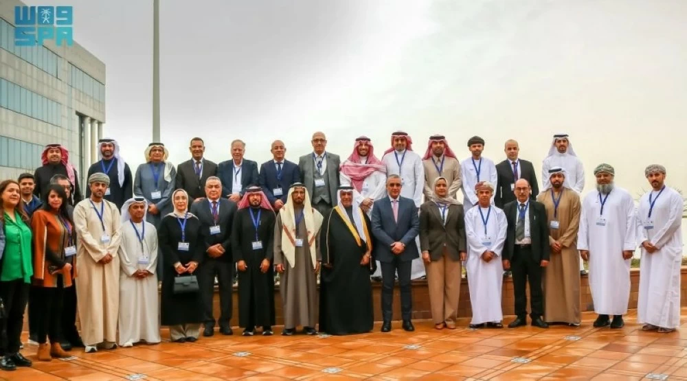
ترأست السعودية، ممثلةً بالهيئة العامة للمساحة والمعلومات الجيومكانية، الاجتماع الثالث عشر للجنة العربية لخبراء الأمم المتحدة لإدارة المعلومات الجيومكانية، الذي عُقد في الجمهورية التونسية خلال يومي 3 و4 فبراير 2026، بمشاركة ممثلي الدول العربية والمنظمات الإقليمية والدولية ذات العلاقة.
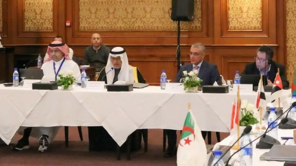
ناقش الاجتماع عدداً من الموضوعات في جدول الأعمال، تضمن التقرير السنوي للجنة العربية، وإسهامات منظمة الأمم المتحدة والمنظمات الدولية في مجال المعلومات الجيومكانية، إضافةً إلى مناقشة أعمال فريق الإطار الجيوديسي، وفريق الإطار المتكامل للمعلومات الجيومكانية، وفريق الحوكمة الجيومكانية.
كما تضمن جدول الأعمال عرض عدد من التجارب الوطنية للدول الأعضاء؛ حيث استعرضت المملكة العربية السعودية تجربتها في قياس النضج الجيومكاني، حيث تتبوأ المملكة مكانة عالمية متقدمة في مجال المعلومات الجيومكانية، سعياً منها إلى التميز في هذا المجال.
وقدمت الجمهورية التونسية عرضاً حول اعتماد الإطار المتكامل للمعلومات الجيومكانية، إلى جانب استعراض مشروع البنية التحتية الوطنية للمعلومات الجغرافية والمعايير الوطنية وبرامج التكوين في المجال الجيومكاني، كما شاركت جمهورية العراق خطتها الوطنية لتطبيق الإطار المتكامل للمعلومات الجيومكانية، إضافةً إلى عروض حول التعاون الدولي وفرص الشراكة مع الدول الأعضاء.
وشهد الاجتماع مشاركة عددٍ من المسؤولين والخبراء والمختصين من الدول العربية الأعضاء، وممثلي سكرتارية لجنة خبراء الأمم المتحدة لإدارة المعلومات الجيومكانية العالمية، إضافةً إلى خبراء ومنظمات دولية ذات صلة بالقطاع، حيث تم تبادل التوجهات وأفضل الممارسات الإقليمية والدولية، ومتابعة مستوى التقدم في أعمال فرق العمل المنبثقة عن اللجنة.
وأكدت المملكة خلال الاجتماع أهمية المتابعة والتنسيق بين الدول العربية، وتعزيز تطبيق الحوكمة الجيومكانية، وتطوير البنى التحتية الجيومكانية، بما يُسهم في رفع كفاءة إدارة المعلومات الجيومكانية ودعم القرارات المبنية على بيانات دقيقة وموثوقة.
Saudi Arabia, represented by the General Authority for Survey and Geospatial Information, chaired the thirteenth meeting of the Arab Committee of United Nations Experts on Geospatial Information Management, which was held in the Republic of Tunisia on February 3 and 4, 2026, with the participation of representatives from Arab countries and relevant regional and international organizations.
The meeting discussed several agenda items, including the annual report of the Arab Committee, contributions from the United Nations and international organizations in the field of geospatial information, in addition to discussions on the work of the Geodetic Framework Team, the Integrated Geospatial Information Framework Team, and the Geospatial Governance Team.
The agenda also included presentations of several national experiences from member states; the Kingdom of Saudi Arabia showcased its experience in measuring geospatial maturity, as the Kingdom holds a leading global position in the field of geospatial information, striving for excellence in this area.
The Republic of Tunisia presented a report on the adoption of the Integrated Geospatial Information Framework, along with an overview of the National Geographic Information Infrastructure project, national standards, and training programs in the geospatial field. The Republic of Iraq also shared its national plan for implementing the Integrated Geospatial Information Framework, in addition to presentations on international cooperation and partnership opportunities with member states.
The meeting witnessed the participation of several officials, experts, and specialists from the member Arab countries, representatives of the Secretariat of the United Nations Committee of Experts on Global Geospatial Information Management, as well as experts and international organizations related to the sector, where trends and best regional and international practices were exchanged, and the level of progress in the work of the task forces emanating from the committee was monitored.
During the meeting, the Kingdom emphasized the importance of follow-up and coordination among Arab countries, enhancing the application of geospatial governance, and developing geospatial infrastructures, which contributes to improving the efficiency of geospatial information management and supporting decisions based on accurate and reliable data.