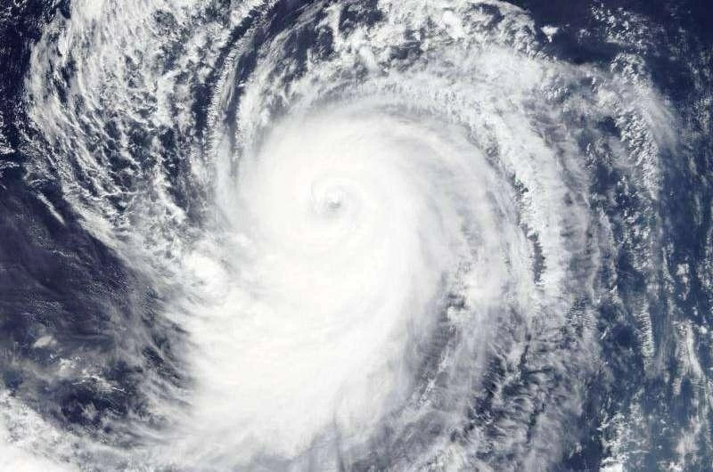
أعلنت السلطات المحلية في اليابان اقتراب إعصار ضخم من جزر «ساكيشيما» التابعة لمقاطعة أوكيناوا جنوبي البلاد، متزامناً مع إطلاق مسؤولي الأرصاد تحذيرات عاجلة تدعو السكان للبقاء في أقصى درجات التأهب والحيطة لمواجهة رياح عاتية وأمطار غزيرة.
وبدأت طلائع الإعصار بالتأثير المباشر على الجزر؛ حيث سجلت محطات الرصد فجر (الجمعة) هبات رياح بلغت سرعتها نحو 150 كيلومتراً في الساعة في مطار «يوناجوني»، ونحو 105 كيلومترات في الساعة في مدينة «إيشيجاكي».
ويتوقع خبراء الطقس أن يشتد الإعصار خلال الساعات القادمة؛ إذ قد تصل سرعة الرياح المستمرة إلى 144 كيلومتراً في الساعة، بينما يتوقع أن تلامس سرعة الهبات العاصفة حاجز 216 كيلومتراً في الساعة.
وعلى صعيد الهطولات المطرية، تشير التوقعات إلى بلوغ إجمالي كميات الأمطار المتراكمة خلال 24 ساعة -حتى وقت متأخر من ليلة (الجمعة)- نحو 250 مليمتراً في عموم مقاطعة أوكيناوا.
كما يُحتمل تشكل حزام من السحب الرعدية الممطرة بغزارة فوق منطقتي «مياكوجيما» و«ياياما» بدءاً من فترة ما بعد ظهر (الجمعة) وحتى فجر (السبت).
ودعت وكالة الأرصاد الجوية اليابانية المواطنين إلى توخي أقصى درجات الحذر واليقظة في مواجهة الرياح العنيفة والأمواج المرتفعة والمد البحري والانهيارات الأرضية الناجمة عن الأمطار.
The local authorities in Japan announced that a massive typhoon is approaching the "Sakishima" Islands, which belong to Okinawa Prefecture in the south of the country, coinciding with urgent warnings from meteorological officials urging residents to remain on high alert and take precautions against strong winds and heavy rain.
The initial effects of the typhoon have started to directly impact the islands; monitoring stations recorded wind gusts reaching speeds of about 150 kilometers per hour at "Yunaguni" Airport, and around 105 kilometers per hour in the city of "Ishigaki" early on Friday.
Weather experts expect the typhoon to intensify in the coming hours; sustained wind speeds may reach 144 kilometers per hour, while gusts are expected to touch 216 kilometers per hour.
Regarding rainfall, forecasts indicate that the total accumulated rainfall over 24 hours - until late Friday night - could reach about 250 millimeters across Okinawa Prefecture.
Additionally, there is a possibility of a band of heavy thunderstorm clouds forming over the "Miyakojima" and "Yaeyama" regions starting from Friday afternoon until Saturday dawn.
The Japan Meteorological Agency urged citizens to exercise the utmost caution and vigilance in the face of violent winds, high waves, tidal surges, and landslides resulting from the rain.