لقرون طويلة، ضُلِّل العالم بشأن الحجم الحقيقي لإفريقيا، عبر خريطة مركاتور، وهي من أكثر الخرائط استخداما، إذ قلّصت مساحة القارة، وشوّهت حجمها وقلصت امتدادها العالمي.
وأيد الاتحاد الإفريقي حملة لإنهاء استخدام خريطة تعود للقرن السادس عشر لصالح خريطة تعرض حجم إفريقيا بشكل أكثر دقة.
ويؤدي إسقاط مركاتور للعالم إلى تشويه أحجام بعض القارات، مما يتسبب في توسيع المناطق القريبة من القطبين مثل أمريكا الشمالية وغرينلاند بينما يؤدي إلى انكماش إفريقيا وأمريكا الجنوبية.
وهذه الخريطة التي تستخدمها حاليًا العديد من الحكومات والمنظمات الدولية، بالإضافة إلى المدارس وشركات التكنولوجيا.
وتحولت خرائط قوقل من استخدام عرض ميركاتور على أجهزة الكمبيوتر إلى عرض الكرة الأرضية ثلاثي الأبعاد في عام 2018، مع إمكانية العودة إلى ميركاتور إذا رغبوا في ذلك. لكن يبقى ميركاتور هو الخيار الافتراضي الوحيد على تطبيق الهاتف المحمول، بينما أعلن البنك الدولي تحوله التدريجي عن الخريطة التقليدية.
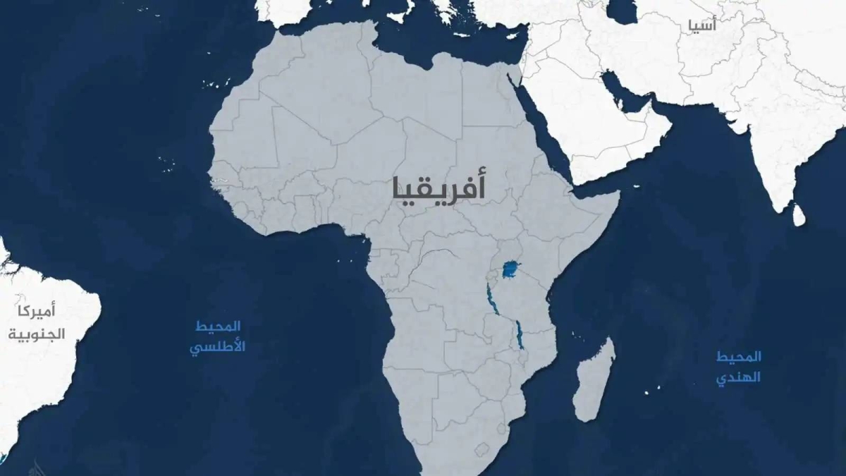
وتغطي إفريقيا مساحة 30.37 مليون كيلومتر مربع، وهي مساحة واسعة بما يكفي لاحتواء الولايات المتحدة والصين والهند ومعظم أوروبا مجتمعة.
ومع ذلك، في الفصول الدراسية، ووسائل الإعلام، والمنشورات، وقاعات الاجتماعات حول العالم، يُظهر إسقاط مركاتور إفريقيا أصغر بكثير مما هي عليه في الواقع.
وقد صُممت هذه الخريطة للملاحة البحرية في القرن السادس عشر، وهي تُوسع بشكل مصطنع مناطق الشمال العالمي، بينما تُقلل بشكل كبير من الحجم المُتصور لقارات مثل إفريقيا. والنتيجة، هي رؤية عالمية مشوهة تُقلل من أهمية إفريقيا الاقتصادية والثقافية والسياسية.
وتدعو حملة منظمتي «إفريقيا بلا فلتر» و«سبيك أب إفريقيا» لإنهاء هذه الكذبة المُستمرة، داعية المنظمات الدولية، بما فيها الأمم المتحدة والبنك الدولي وهيئة الإذاعة البريطانية (بي بي سي)، إلى اعتماد خريطة «الأرض المتساوية»، التي تُمثّل الجغرافيا العالمية تمثيلاً أكثر عدلًا ودقة.
ومن خلال عريضة عالمية وبيان الحملة، تدعو المبادرة المؤسسات والمعلمين والمنافذ الإعلامية إلى الالتزام باستخدام الخرائط التي تعكس الحجم الحقيقي لأفريقيا.
وكتب مؤسس ومدير تنفيذي لمنظمة «تحدثوا عن أفريقيا» ياسين جيبو أن القرارات المتعلقة بأفريقيا -الاقتصادية والسياسية والتنموية - تُتخذ على أساس إطار مرجعي خاطئ إذ يتعين على العالم أن يرى أفريقيا كما هي في الواقع.
كما أوضحت نائبة رئيس مفوضية الاتحاد الأفريقي سلمى حدادي، في تصريح لها، أن خريطة مركاتور تظهر أفريقيا أصغر من حجمها الحقيقي، رغم أنها ثاني أكبر قارة في العالم، وتضم 54 دولة وأكثر من مليار نسمة.
وأشارت حدادي إلى أن هذه الخطوة تهدف لـ«استعادة مكانة أفريقيا المستحقة عالميا».
For centuries, the world has been misled about the true size of Africa, through the Mercator map, which is one of the most widely used maps, as it shrank the continent's area, distorted its size, and reduced its global extent.
The African Union has supported a campaign to end the use of a 16th-century map in favor of a map that depicts Africa's size more accurately.
The Mercator projection of the world distorts the sizes of some continents, causing areas near the poles, such as North America and Greenland, to appear larger while shrinking Africa and South America.
This map is currently used by many governments and international organizations, as well as schools and technology companies.
Google Maps transitioned from using the Mercator projection on computers to a 3D globe view in 2018, with the option to revert to Mercator if desired. However, Mercator remains the only default option on the mobile app, while the World Bank announced its gradual shift away from the traditional map.
Africa covers an area of 30.37 million square kilometers, which is large enough to contain the United States, China, India, and most of Europe combined.
However, in classrooms, media, publications, and meeting rooms around the world, the Mercator projection shows Africa as much smaller than it actually is.
This map was designed for maritime navigation in the 16th century, artificially enlarging the areas of the Global North while significantly reducing the perceived size of continents like Africa. The result is a distorted global view that diminishes Africa's economic, cultural, and political significance.
A campaign by the organizations "Africa No Filter" and "Speak Up Africa" calls for an end to this ongoing lie, urging international organizations, including the United Nations, the World Bank, and the BBC, to adopt the "Equal Earth" map, which represents global geography more fairly and accurately.
Through a global petition and campaign statement, the initiative calls on institutions, educators, and media outlets to commit to using maps that reflect Africa's true size.
Yassine Jibou, founder and CEO of the "Talk About Africa" organization, wrote that decisions regarding Africa—economic, political, and developmental—are made based on a flawed frame of reference, and the world needs to see Africa as it truly is.
Salma Haddadi, Deputy Chairperson of the African Union Commission, clarified in a statement that the Mercator map shows Africa as smaller than its actual size, even though it is the second-largest continent in the world, comprising 54 countries and over a billion people.
Haddadi noted that this step aims to "restore Africa's rightful global standing."