


توقّع المركز الوطني للأرصاد هطول أمطار متوسطة إلى غزيرة على عدد من محافظات منطقة مكة المكرمة، ابتداءً من اليوم (السبت) وحتى (الأربعاء) القادم.
وتشمل الحالة المطرية العاصمة المقدسة ومحافظات الكامل والجموم وبحرة والطائف وميسان وأضم والعرضيات والليث والقنفذة.
وأهاب الدفاع المدني بالجميع إلى أخذ الحيطة والحذر، والالتزام بتعليماته وإرشاداته، حفاظاً على سلامتهم خلال الحالة المطرية.
توقع المركز الوطني للأرصاد في تقريره عن حالة الطقس اليوم (السبت)، استمرار هطول أمطار رعدية متوسطة إلى غزيرة على أجزاء من 8 مناطق في المملكة، مصحوبة بزخات من البَرَد ورياح نشطة مثيرة للأتربة والغبار، قد تؤدي إلى جريان السيول وشبه انعدام مدى الرؤية الأفقية.
وأوضح المركز أن الحالة المطرية تشمل مناطق جازان، عسير، الباحة، مكة المكرمة، تبوك، الجوف، والحدود الشمالية، فيما تكون الأمطار خفيفة إلى متوسطة على أجزاء من منطقتي المدينة المنورة وحائل.
وأشار التقرير إلى استمرار فرص تكوّن السحب الرعدية الممطرة على الأجزاء الجنوبية من المنطقة الشرقية، مع احتمالية تشكّل الضباب خلال الليل وساعات الصباح الباكر على الأجزاء الساحلية منها. كما تشمل فرص تكوّن الضباب الأجزاء الساحلية من منطقتي مكة المكرمة والمدينة المنورة، ما قد يؤثر في مدى الرؤية الأفقية، خصوصاً خلال ساعات الصباح الأولى.
وفي ما يتعلق بحالة البحر الأحمر، توقع المركز أن تكون الرياح السطحية شمالية غربية إلى غربية بسرعة تتراوح بين 15 و35 كيلومتراً في الساعة على الجزء الشمالي، وقد تتجاوز 50 كيلومتراً في الساعة مع تكوّن السحب الرعدية الممطرة. أما على الجزأين الأوسط والجنوبي، فتكون الرياح جنوبية غربية إلى شمالية غربية بسرعة تتراوح بين 10 و25 كيلومتراً في الساعة، وقد تتجاوز 50 كيلومتراً في الساعة أثناء نشاط السحب الرعدية. ويتراوح ارتفاع الموج بين نصف متر ومتر ونصف على الجزء الشمالي، وبين نصف متر ومتر على الجزأين الأوسط والجنوبي، مع احتمالية ارتفاعه إلى أكثر من مترين في المناطق المتأثرة بالسحب الرعدية. وتكون حالة البحر خفيفة إلى متوسطة الموج شمالاً، وخفيفة الموج في الجزأين الأوسط والجنوبي، وتصل إلى مائجة مع نشاط السحب الرعدية الممطرة.
أمطار متوسطة إلى غزيرة على مكة ومحافظاتها حتى الأربعاء
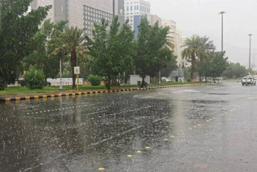


The National Center of Meteorology expects moderate to heavy rainfall in several governorates of the Makkah region, starting today (Saturday) until next (Wednesday).
This rainy condition includes the holy capital and the governorates of Al-Kamil, Al-Jumum, Bahra, Taif, Maysan, Adham, Al-Ardiyat, Al-Lith, and Al-Qunfudhah.
The Civil Defense urged everyone to take precautions and adhere to its instructions and guidelines to ensure their safety during the rainy condition.
The National Center of Meteorology, in its weather report for today (Saturday), predicted the continuation of moderate to heavy thunderstorm rains in parts of 8 regions in the Kingdom, accompanied by showers of hail and active winds that stir up dust and sand, which may lead to flash floods and near-zero horizontal visibility.
The center clarified that the rainy condition includes the regions of Jazan, Asir, Al-Baha, Makkah, Tabuk, Al-Jouf, and the Northern Borders, while the rains are expected to be light to moderate in parts of the Madinah and Ha'il regions.
The report indicated the continued chances of thunderstorm cloud formation in the southern parts of the Eastern Province, with the possibility of fog formation during the night and early morning hours in its coastal areas. The chances of fog formation also include the coastal areas of the Makkah and Madinah regions, which may affect horizontal visibility, especially during the early morning hours.
Regarding the condition of the Red Sea, the center expected the surface winds to be northwesterly to westerly at speeds ranging from 15 to 35 kilometers per hour in the northern part, and may exceed 50 kilometers per hour with the formation of thunderstorm clouds. In the central and southern parts, the winds are expected to be southwesterly to northwesterly at speeds ranging from 10 to 25 kilometers per hour, and may exceed 50 kilometers per hour during the activity of thunderstorm clouds. Wave heights are expected to range from half a meter to one and a half meters in the northern part, and between half a meter and one meter in the central and southern parts, with the possibility of rising to more than two meters in areas affected by thunderstorm clouds. The sea condition is expected to be light to moderate in the north, and light in the central and southern parts, reaching choppy with the activity of thunderstorm rains.


