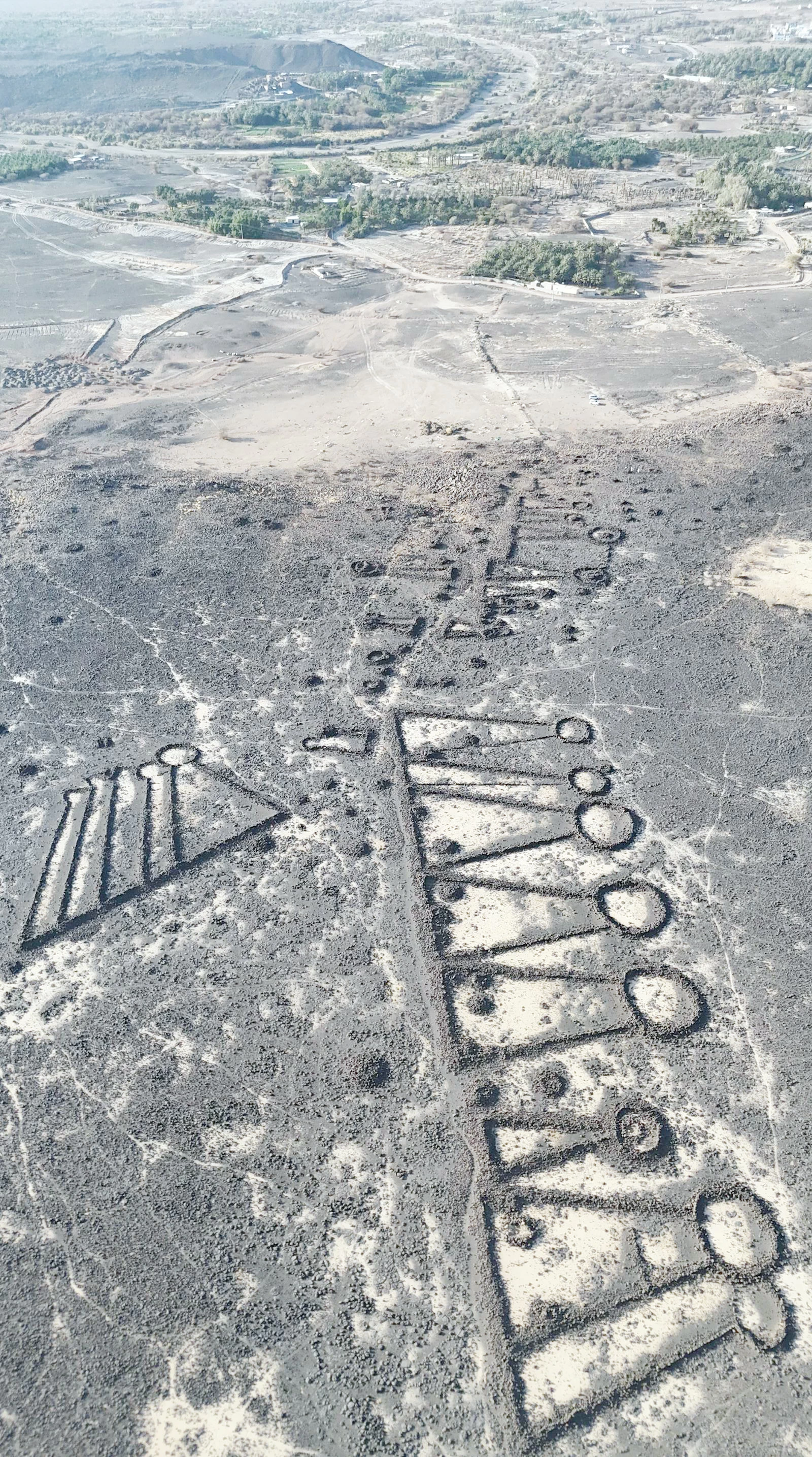
تنتشر المذيلات الحجرية في العُلا وخيبر وتيماء، بوصفها شواهد أثرية بارزة على تاريخ الاستقرار البشري في شمال غرب شبه الجزيرة العربية، وتتركز في الحرات البركانية والأودية وبالقرب من الواحات ومصادر المياه.
وتتكون هذه المنشآت من مدفن رئيس تتصل به امتدادات حجرية تشبه الذيل، وتتباين في أشكالها وأحجامها، فيما تشير الدراسات الأثرية إلى أن عدداً كبيراً منها يعود إلى العصر البرونزي.
ووثقت الهيئة الملكية لمحافظة العُلا، ارتباط أعداد كبيرة من هذه المدافن بمسارات طويلة تُعرف بـ«الطرق الجنائزية»، امتدت بين الواحات والمراعي ومصادر المياه لنحو 530 كيلومترًا، عاكسة أنماط التنقل والترابط بين التجمعات السكانية القديمة.
وتشير الدراسات إلى أن هذه الشواهد تعكس جوانب من الحياة الاجتماعية والاقتصادية لمجتمعات شمال غرب شبه الجزيرة العربية، فيما يُرجح ارتباط الطرق الجنائزية بالحركة الموسمية للرعاة وقطعانهم، ودورها في تعزيز التواصل بين التجمعات.
The stone mounds are spread across Al-Ula, Khaybar, and Tayma, serving as prominent archaeological markers of human settlement history in the northwest of the Arabian Peninsula. They are concentrated in volcanic fields, valleys, and near oases and water sources.
These structures consist of a main burial chamber connected to stone extensions resembling tails, varying in shapes and sizes, while archaeological studies indicate that a large number of them date back to the Bronze Age.
The Royal Commission for Al-Ula Governorate has documented the connection of a significant number of these tombs to long pathways known as "funerary roads," which extended between oases, pastures, and water sources for about 530 kilometers, reflecting patterns of movement and connectivity among ancient population clusters.
Studies suggest that these markers reflect aspects of the social and economic life of communities in the northwest of the Arabian Peninsula, while it is likely that the funerary roads were associated with the seasonal movement of herders and their flocks, playing a role in enhancing communication between settlements.