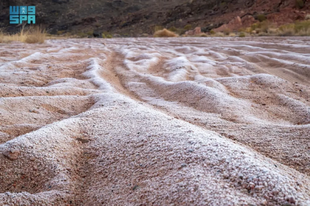
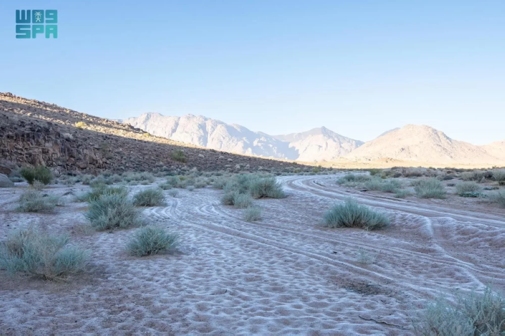
شهدت أجزاء من شمال غرب منطقة تبوك فجر اليوم، انخفاضًا ملحوظًا في درجات الحرارة في المناطق المفتوحة والمرتفعات، ما أدى إلى تكوّن الصقيع في الأماكن المكشوفة، وذلك مع استمرار الموجة الباردة التي تؤثر في شمال المملكة -بحسب تنبيهات المركز الوطني للأرصاد- الذي أكد استمرار الانخفاض في درجات الحرارة المصحوب برياح نشطة على منطقة تبوك، مع توقعات باستمرار الأجواء الباردة خلال الأيام القادمة.
2
في غضون ذلك توقّع المركز الوطني للأرصاد في تقريره عن حالة الطقس لهذا اليوم استمرار الانخفاض في درجات الحرارة المصحوب برياح نشطة على مناطق تبوك، والجوف، والحدود الشمالية يمتد إلى أجزاء من مناطق حائل، والقصيم، والرياض، والشرقية، مع فرصة تكون الضباب على أجزاء من تلك المناطق.
رياح على البحر
أشار التقرير إلى أن حركة الرياح السطحية على البحر الأحمر شمالية شرقية إلى شمالية تتحول مساءً شمالية إلى شمالية غربية على الجزء الشمالي والأوسط بسرعة 20 - 45 كم/ساعة، وجنوبية شرقية إلى جنوبية على الجزء الجنوبي بسرعة 12 - 35 كم/ساعة تصل إلى 50 كم/ساعة باتجاه مضيق باب المندب، وارتفاع الموج من متر إلى مترين على الجزء الشمالي والأوسط ومن نصف المتر إلى متر ونصف على الجزء الجنوبي يصل إلى أعلى من مترين باتجاه مضيق باب المندب، وحالة البحر متوسط الموج على الجزء الشمالي والأوسط وخفيف إلى متوسط الموج على الجزء الجنوبي يصل إلى مائج باتجاه مضيق باب المندب، فيما تكون حركة الرياح على الخليج العربي شمالية غربية بسرعة 25 - 50 كم/ساعة، وارتفاع الموج من متر ونصف إلى مترين ونصف، وحالة البحر متوسط الموج إلى مائج.
Parts of northwestern Tabuk region witnessed a noticeable drop in temperatures in open areas and highlands early this morning, leading to frost formation in exposed places, as the cold wave continues to affect the northern region of the Kingdom - according to alerts from the National Center of Meteorology - which confirmed the continued drop in temperatures accompanied by active winds in the Tabuk region, with expectations of cold weather persisting in the coming days.
2
Meanwhile, the National Center of Meteorology predicted in its weather report for today that the drop in temperatures accompanied by active winds would continue in the regions of Tabuk, Al-Jawf, and the Northern Borders, extending to parts of the regions of Hail, Al-Qassim, Riyadh, and the Eastern Province, with a chance of fog formation in parts of those areas.
Winds over the Sea
The report indicated that the surface wind movement over the Red Sea is from the northeast to the north, shifting in the evening to the north and northwest in the northern and central parts at a speed of 20 - 45 km/h, and from the southeast to the south in the southern part at a speed of 12 - 35 km/h, reaching up to 50 km/h towards the Bab el-Mandeb Strait. The wave height ranges from one to two meters in the northern and central parts and from half a meter to one and a half meters in the southern part, reaching over two meters towards the Bab el-Mandeb Strait. The sea condition is moderate in the northern and central parts and light to moderate in the southern part, becoming rough towards the Bab el-Mandeb Strait, while the wind movement over the Arabian Gulf is from the northwest at a speed of 25 - 50 km/h, with wave heights ranging from one and a half to two and a half meters, and the sea condition is moderate to rough.