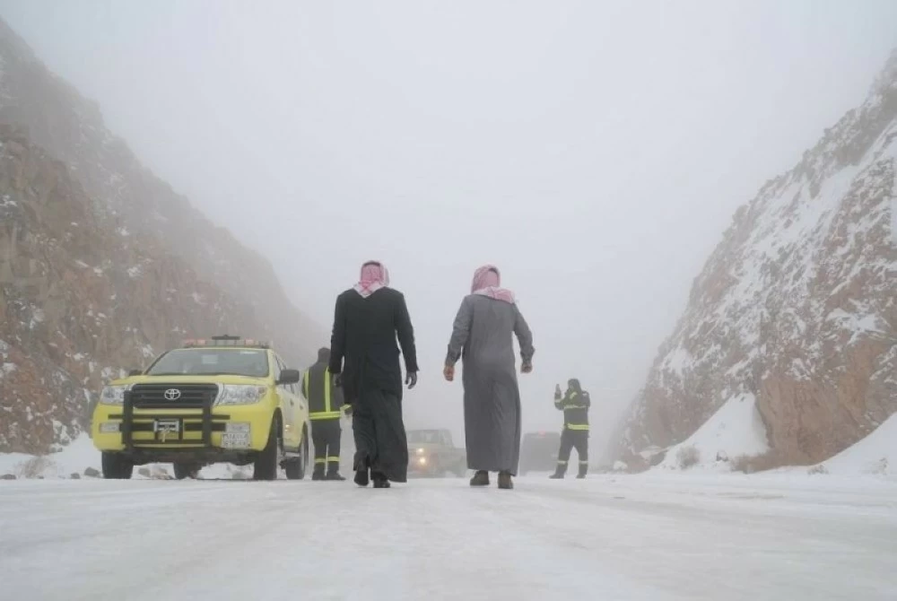
أكد المتحدث باسم المركز الوطني للأرصاد حسين القحطاني وصول أول موجة باردة ستشهدها مناطق المملكة نهاية الأسبوع الجاري، مشيراً إلى احتمالية ملامسة الصفر المئوي على الشمال، وذلك عقب جولة مطرية بدأت الأحد وتستمر حتى الخميس تشمل 13 منطقة.
وتتضمن الموجة المطرية عدة ظواهر، منها رياح هابطة قد تصل سرعتها إلى 80 كيلومتراً في الساعة أو أكثر، إضافة إلى تساقط البرد وارتفاع الأمواج وجريان السيول.
أمطار متوسطة إلى غزيرة
ونبّه المركز الوطني للأرصاد من أمطار متوسطة قد تصل إلى غزيرة على منطقة المدينة المنورة، تشمل المدينة المنورة، ومحافظات ينبع، والعُلا، والعيص، وخيبر، وبدر، والحناكية، ووادي الفرع، والمهد، وذلك خلال فترات زمنية مختلفة.
وأوضح المركز أن الحالة تبدأ من اليوم (الأحد) وتستمر حتى الأربعاء القادم، على أن يشهد يوما الثلاثاء والأربعاء فرصاً لهطول أمطار من متوسطة إلى غزيرة.
The spokesperson for the National Center of Meteorology, Hussein Al-Qahtani, confirmed the arrival of the first cold wave that will affect regions of the Kingdom at the end of this week, indicating the possibility of temperatures touching zero degrees Celsius in the north. This comes after a rainy spell that began on Sunday and will continue until Thursday, covering 13 regions.
The rainy wave includes several phenomena, such as descending winds that may reach speeds of 80 kilometers per hour or more, in addition to hail, rising waves, and flowing torrents.
Moderate to Heavy Rain
The National Center of Meteorology warned of moderate to heavy rain in the Medina region, including Medina city, and the governorates of Yanbu, Al-Ula, Al-Ais, Khaybar, Badr, Al-Hanakia, Wadi Al-Far, and Al-Mahd, during different time periods.
The center clarified that the situation begins today (Sunday) and will continue until next Wednesday, with opportunities for moderate to heavy rain expected on Tuesday and Wednesday.