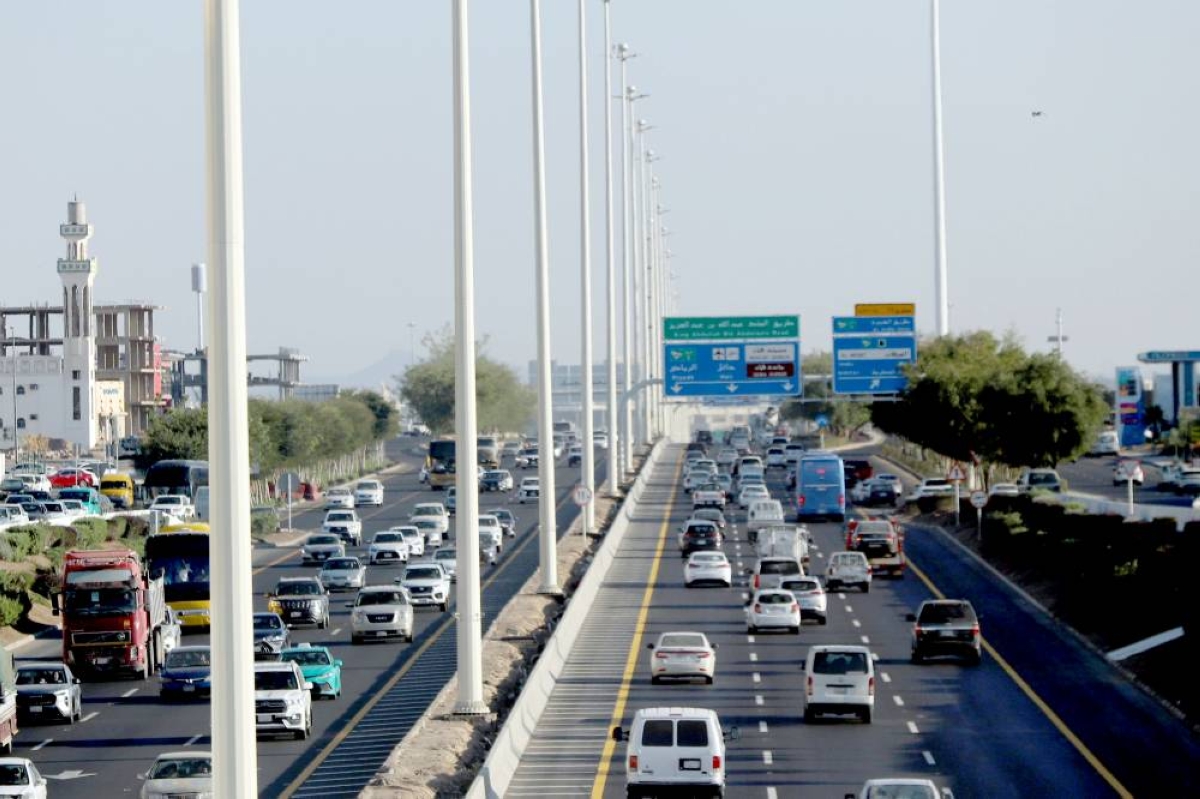
أعلنت هيئة تطوير المدينة المنورة، أطوال الطرق في الأحياء في مؤشر أطلس عن الحالة التنموية المستدامة قياساً بالكيلومتر الطولي. ويقيم التقرير مستوى تطور البنية التحتية للنقل ومدى تأثيرها في دعم الاقتصاد وتعزيز التنمية العمرانية. وأشار التقرير إلى أن أكثر الأحياء ارتفاعاً في أطوال الطرق: الدفاع بطول 328.6كم، يليه حي العزيزية بطول 262.7كم، يليه السلام بطول 237.4كم، ثم العاقول بطول 233.2كم.
وأكثر الأحياء ارتفاعاً في الداخل الأصفيرين 41.2 كم/كم2، السيح 35.5 كم/كم2، المغسيلية 34.6 كم/كم2، العنابس 33.5 كم/كم2، ثم حي السقيا 31.1 كم/كم2.
وقسم التقرير الطرق إلى 4 نطاقات حسب هيكلة شبكة الطرق؛ الأول: الأحياء المحصورة بين الطريق الدائري الأول وطريق الأمير عبد المجيد. الثاني: الأحياء المحصورة بين طريق الأمير عبدالمجيد والطريق الدائري الثاني. الثالث: الأحياء المحصورة بين الطريق الدائري الثاني وطريق الأمير نايف بن عبدالعزيز. والنطاق الرابع: الأحياء المحصورة بين طريق الأمير نايف بن عبدالعزيز والطريق الدائري الثالث.
ولفت التقرير إلى أن أكثر من ثلث أطوال شبكة الحركة بالمدينة تقع في النطاق الثالث، ما بين الطريق الدائري الثاني.
وكشف المهندس الاستشاري كمال رشيد القبلي، الجوانب الفنية للطرق في المدينة من خلال تقرير مؤشرات الطرق لهيئة تطوير المدينة وقال لـ«عكاظ»: «كلما اقتربنا من وسط المدينة تقل أطوال الطرق، وتقل مساحات الأحياء وعدد السكان، وكلما ابتعدنا عن وسط المدينة زادت أطوال الشوارع، وزادت مساحات الأحياء وعدد السكان، وهذا يعطي مؤشراً إلى الحاجة لوسائل نقل عام في هذه المناطق الكبيرة، ودراسة احتياجات تلك المناطق من الأسواق والمنتجات المختلفة حتى لا يضطر السكان للدخول إلى وسط المدينة».
وأضاف: «هذه المؤشرات تساعد كثيراً في دراسة الحاجة للمدارس والمستشفيات والمساجد والمعاهد التدريبية والنوادي الرياضية والترفيهية وفقاً لحاجة ومساحة الأحياء وسكانها، خصوصاً البعيدة منها، وفقاً لأطوال الشوارع بها، ليكون التوزيع السكاني مدروساً بعناية مع توفر الخدمات».
وأوصى القبلي الأمانة بتشجيع التملك في بعض الأحياء بمنح مميزات مثل تخفيض تكاليف الاستهلاك الكهربائي والمياه ورسوم الرخص، وإعطاء امتيازات تجارية لتكثيف السكان في تلك المناطق للاستخدام الأمثل للمرافق والخدمات، وأن تكون خدمة سيارات التاكسي في وسط المدينة وذات الأطوال القصيرة في الشوارع ثم تزيد الحاجة إلى الحافلات في الأحياء التالية وخدمات العام بواسطة الباصات الكبيرة في الأحياء البعيدة وذات الطرقات الطويلة.
واقترح القبلي على الأمانة، القيام بمبادرات متكررة لعرض تلك المؤشرات من خلال محاضرات وندوات عامة للتثقيف والتعريف لتمكين المواطنين والمستثمرين وأصحاب نشاطات التطوير العقاري من بناء خططهم للتطوير والاستثمارات العقارية وفقاً لتلك المؤشرات.
استشاري هندسي يحلل الحالة..
«تطوير المدينة» تعلن أطوال الطرق في حدود وداخل الأحياء
27 يوليو 2025 - 01:49
|
آخر تحديث 27 يوليو 2025 - 02:31
تابع قناة عكاظ على الواتساب
سامي المغامسي (المدينة المنورة) sami4086@
The Medina Development Authority announced the lengths of roads in neighborhoods in the Atlas Index as a measure of sustainable development based on linear kilometers. The report evaluates the level of infrastructure development in transportation and its impact on supporting the economy and enhancing urban development. The report indicated that the neighborhoods with the longest road lengths are: Al-Difa' with a length of 328.6 km, followed by Al-Aziziyah with 262.7 km, then Al-Salam with 237.4 km, and finally Al-Aqoul with 233.2 km.
The neighborhoods with the highest lengths in the interior are: Al-Asfairin with 41.2 km/km², Al-Saih with 35.5 km/km², Al-Maghsiliyah with 34.6 km/km², Al-Anabis with 33.5 km/km², and then Al-Suqiya neighborhood with 31.1 km/km².
The report divided the roads into four zones based on the structure of the road network; the first: neighborhoods located between the first ring road and Prince Abdul Majid Road. The second: neighborhoods located between Prince Abdul Majid Road and the second ring road. The third: neighborhoods located between the second ring road and Prince Naif bin Abdulaziz Road. The fourth zone: neighborhoods located between Prince Naif bin Abdulaziz Road and the third ring road.
The report pointed out that more than one-third of the lengths of the movement network in the city are located in the third zone, between the second ring road.
Consulting engineer Kamal Rashid Al-Qabli revealed the technical aspects of the roads in the city through the Road Indicators Report for the Medina Development Authority and said to "Okaz": "The closer we get to the city center, the shorter the road lengths become, and the smaller the areas of the neighborhoods and the number of residents. The further we move away from the city center, the longer the streets become, and the larger the areas of the neighborhoods and the number of residents, which indicates the need for public transport in these large areas, and the study of the needs of those areas for markets and various products so that residents do not have to enter the city center."
He added: "These indicators greatly assist in studying the need for schools, hospitals, mosques, training institutes, and sports and recreational clubs according to the needs and areas of the neighborhoods and their residents, especially those that are far away, based on the lengths of the streets there, so that the population distribution is carefully studied with the availability of services."
Al-Qabli recommended that the municipality encourage ownership in some neighborhoods by providing incentives such as reducing electricity and water consumption costs and license fees, and granting commercial privileges to increase the population density in those areas for optimal use of facilities and services. He suggested that taxi services be available in the city center and in short street lengths, then the need for buses increases in the following neighborhoods, and public transport services should be provided by large buses in distant neighborhoods with long roads.
Al-Qabli proposed to the municipality to carry out repeated initiatives to present these indicators through lectures and public seminars for education and awareness to empower citizens, investors, and real estate development activity owners to build their development plans and real estate investments based on those indicators.